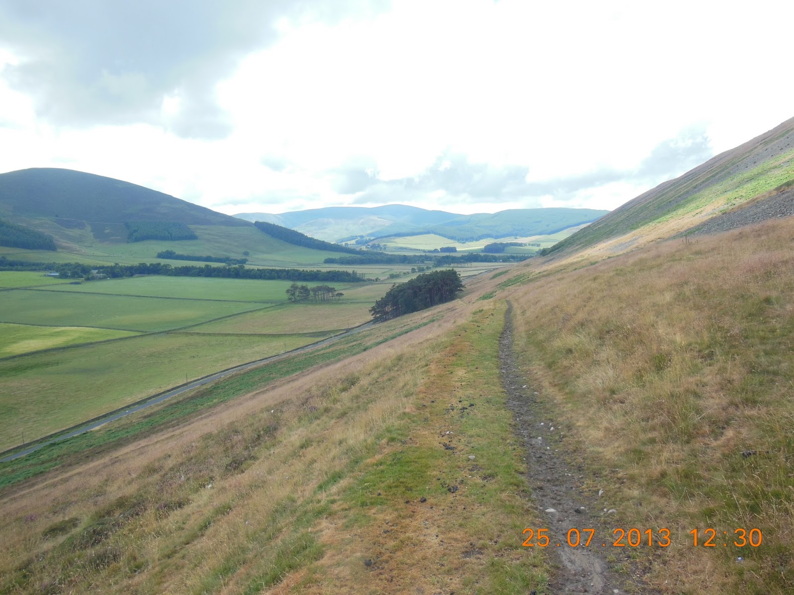
Wednesday 31 July 2013

Central Glasgow to Milngavie

This was to be the last day of walking in 2013, with the modest objective of reaching the start of the West Highland Way in Milngavie (pronounced mull-GUY), a suburb some six miles North of the city centre. The route was to be by the Kelvin Way, which follows the River Kelvin for most of the way, and then the Allender Way for the last quarter of the walk. It’s marked on the map as both a footpath and cycle way.

A view from the Kelvin Walkway
And so it is for the first section, which runs through the valley of the Kelvin, a moderately sized river, through Glasgow’s Western suburbs. There were plenty of dog-walkers and cyclists, but no other obvious long-distance travellers. It’s pleasant enough walking, with the city largely hidden behind trees, and much of it is parkland. It also goes through the City’s Botanical Garden and arboretum.

At Maryhill the path leaves the river, and cuts the corner to rejoin the Kelvin a couple of kilometres away to the North of Summerston, a much newer suburb.

Glasshouses in the Glasgow Botanical Gardens
There the character of the path changes. It’s no longer a metalled path, but a muddy riverside walk, which involves pushing through waist-high vegetation and dodging nettles for much of the next few kilometres. After half an hour of this the path enters a wood, where at lest there was he vestige of an old road. Then one reaches the A879, which is busy and dangerous for walking. So it was more of the riverside path.

More of the invasive Himalayan Balsam that's all
around Glasgow's rivers
The Kelvin Walkway involves a great loop to the East, with the result that it’s probably twice the distance as by road. It’s also obvious that after the A879 it’s no longer a cycleway, so goodness knows why it’s marked as such. It’s not even much of a path. For most of the next couple of miles it’s more wading through vegetation with uncertain footing – very slow going. I don’t think I’ve had a more overgrown route since walking along the Severn near Bristol last year. It was astonishing that I didn’t get more badly stung and scratched. I certainly regretted not having walking poles, as I’d expected a totally flat and easy route. Poles serve the additional purpose of pushing offending vegetation out of the way.

At last this overgrown section was over – and the reward was the Tickled Trout, a pub just off the riverbank. Here I had a very welcome pint.

The final stretch into Milngavie
Then it was time for the last two miles into Milngavie. This was much easier, and the first time that I had seen anyone else walking the path. In the centre of the town there were reassuring signs that this was indeed the start of the West Highland Way.

I arrived at the station just in time to catch a train back to Glasgow. There I visited the Glasgow Museum of Modern Art - GoMA, to mirror New York’s MOMA, but in my view little to recommend the visit apart from the building itself. Then it was back to the Argyll Hotel to change out of my boots and retrieve my luggage, and a taxi to the central station for my train back to London.

The start of the challenge for 2014!
This was a wonderful, comfortable trip – First Class for £33.50. The complementary dinner and drinks alone would have cost more in many establishments. The train was less than half full, and it was a fine way to finish the week, hurtling through continuous rain which I would have had to experience if my walk in Scotland had lasted a day longer.

So, that’s it for 2013. No blisters, and the hip  has held up well – though Ibuprofen has been a real help. I had only one minor cramp attack, unusually when actually walking rather than in the night. And after spending most of the last few days walking East to West, I’m ready to resume in a Northerly direction next year.


Very bright and promising to start, but cloud building steadily, so that apart from a brief sunny spell at lunchtime it was overcast. 17-20C. 16.96km. Max altitude 63m, but mainly below 30m. 119m of ascents, 95m of descents. Good paved paths until re-joining the River Kelvin North of Summerston, but then a rough riverside walk and extremely difficult going for about 5km. A good path for the final 3km into Milngavie.

Tuesday 30 July 2013

Bothwell to Central Glasgow

Not for the first time, and I suspect not for the last, the day started with a series of mistakes. The way out of the hotel in the direction of the Clyde was self-evident, but I went too near to the edge of the park. The first well-paved path ended abruptly; an apparent diversion near its end rapidly reached impenetrable thickets of undergrowth. The road I then explored simply became a crescent which would have taken me back to the town centre. Eventually I managed to sort out a routge which delivered me to the riverside.

The Clyde - bigger than yesterday, and the colour
of milk chocolate
From what I had been told the previous day I judged that this was just below the pool where 46 salmon had been caught in a day in 2013. However, it didn’t seem very accessible water, and in any case was probably a good two feet higher than the previous day, and now the colour of milk chocolate. So there was no question of trying to see whether there were fish or fishers about.

With the river so high I was rather apprehensive that the riverside path would be flooded in places. I had read in the guide that there are high water alternatives for some of the sections of the Clyde Walkway. Would they be required today? If so, I would have a challenge: I hadn’t printed or brought with me the Clyde Walkway guides I had found on the internet, and the waymarking was minimal. However, I was in luck. In places the path was only a foot or so above river level, and there were wet stretches, but nothing was actually under water.

The ruins of Bothwell Castle
The first landmark was the ruins of Bothwell Castle, impressively positioned above a bend in the Clyde. Thereafter it was a couple of wooded riverside kilometres before crossing the Clyde to follow the mapped route away from the river, which is also designated as National Cycleway 75. Given that when I rejoined the river there was a sign showing an alternative (and apparently new) route for the Clyde Walkway, I suspect I may have missed a better and more interesting way of covering these three miles. But there was no waymarking, and once again it was cause to regret not having printed the internet guide.

The cross country route was by road, and then along a decommissioned railway line. This passes an electricity substation, which has extraordinary bits of cabling and aluminium bars mounted on top of big brown insulators. Of course I failed to take any photos, which I regretted as soon as I had walked too far beyond to feel like returning. It also makes me realise that I really don’t have the foggiest notion of how electrical engineering works. I may have read physics (rather badly) 50-odd years ago, but it doesn’t teach one anything about practical things like electrical power systems.

After re-reaching the river (and seeing the sign to the new section of eh Clyde Walkway, the rest of the walk into Glasgow was along the river. The first kilometre is along the boundary fence of a huge complex housing the Strathclyde Fire Service: all apparently very new and shiny, with finishing landscaping touches being applied to the surrounding areas. Then it’s across the river, past a series of warehouses and factories.

The Clyde Walkway -
well screened from neighbouring warehouses
For a footpath/cycle track through a major conurbation the Clyde Walkway is usually remarkably well screened from its surroundings. The first section had new plantings of trees and shrubs between the path and the river, though beyond this there were huge areas of Himalayan balsam and giant hogweed. There have been attempts to deal with the hogweed, presumably with roundup or a similar herbicide, but not all of it has been tackled, and it looks even worse where it’s dying.

Giant Hogweed by the banks of the Clyde
As it approaches Glasgow from the Southeast the Clyde meanders significantly. There are no apparent shortcuts, so the distance walked is more than twice the distance as the crow flies. Or actually more. Closer to Glasgow itself there is a huge development called the Clyde Gateway – literally hundreds of new houses and flats, now almost complete with workers tackling the landscaping. Immediately afterwards the Walkway is closed, with a diversion inland. Once again the waymarking is awful. After two or three signs they simply stop, so it’s back to basic navigation skills. Thank goodness for the iPhone mapping app!

The People's Palace on Glasgow Green
Finally one reaches Glasgow Green, the park to the East of the city centre. Here I finally left the Clyde, and made my way through the centre of the city. It’s predominantly a Victorian city, though with s number of rather incongruous more recent additions. It was surprisingly busy, with the pedestrianized parts of Buchanan Street and Sauchihall Street heaving with people.

I had a coffee from Caffè Nero, spilling some of it down my shirt when I failed to put the top on properly, and a trip to M&S to replace worn out clothes. Then it was a long walk along Sauchihsll Street to the Argyll Hotel.

The room was pretty small and basic, but there was a tiny desk where I could write up my travels before forgetting everything. And the Indian restaurant a block away – the Bukhara - was absolutely outstanding.


Bright and sunny throughout, except right at the end of the day, when there were half a dozen spots of rain as I walked down Sauchihall Street to my hotel. 16-22C. 29.79km; 56m maximum altitude at my destination; mostly below 20m. Ascents 199m, descents 228m. For the first part of the day it was all except a few steps on good tracks or paved paths; on reaching Glasgow itself it was all pavements beside city streets.

Monday 29 July 2013

Rosebank to Bothwell

It was goodbye to Stuart and Elinor Goldsmith, who caught a taxi back to New Lanark to retrieve their car and resume their holiday by travelling down to the Lake District. Then it was au revoir to Susan, who caught a taxi to Larkhall to go back to Glasgow and thence down to London. The taxi was also to take my luggage on to Bothwell. So I was back to walking alone. This is one of the penalties of walking a long way from where most of my friends live, and choosing to do so in the peak holiday season.

The bridge back over the Clyde
So it was back up the road to the bridge where we had crossed the Clyde the previous afternoon.

Immediately below the bridge I came across a fisherman, clearly after salmon. I hadn’t realised that they run the Clyde, but apparently it’s one of Scotland’s best kept secrets – and a season ticket costs less than £100. July is early, but the river was clearly well up overnight, so there was a chance of a fish. They run only as far as four miles upstream of Rosebank, as they can’t get past the power station, and they spawn in the main river. One of the spawning redds was immediately underneath the bridge, and apparently large numbers of fish can be seen there at the turn of the year. I was told that 46 fish were caught in one day in a pool, right by the Livingstone Centre in Blantyre. Only six were killed. Though there’s no prohibition on killing fish after (as it happened) that very day in July, most are returned.

The Clyde in spate
The river was already quite coloured after the heavy rain over the previous few days, but still fishable. However, the chap I met was giving up just as we talked. Obviously today was not to be a lucky one.

Then it was on down the Clyde valley. Initially it was pleasant enough, a good path along the river and through woodland, and then a track just beneath rising ground to the North. Soon the path gave way to a concrete farm track, which passed within a few hundred metres of ruined Cambusnethan House – a romantic looking derelict building with towers at either end, peeking out through woods over fields of barley. The track then left the river, and my way became a rough path through pasture and cattle. This was genuine countryside, but was overlooked by half a dozen huge tower blocks on the fringes of Wishaw. This was the beginning of the continuous suburbs to the Southeast of Glasgow – though they are very effectively screened by trees for most of the way.

Cambusnethan House (or is it Priory?)
The path then works its way through Barons Haugh nature reserve, apparently managed (at least in part) by the RSPB, with hides overlooking the lake in the bend of the river. This starts with an avenue of lime trees, and then a path lined with willow scrub along the Clyde, mostly hidden from view behind dense low vegetation. I had already seen quite a lot of Himalayan balsam along the river opposite Rosebank, but here it was really rampant. It’s an invasive plant, related to Impatiens, which really loves damp riversides. It’s become a serious problem in East Anglia, and I remember seeing huge drifts of it along the River Eden near Carlisle a couple of years ago when I walked along Hadrian’s Wall. It’s not unattractive, but can really overwhelm everything else.

Clydesdale Country Park amusements
Although the path is shown on the map as going right along the fringes of Motherwell, it’s actually quite well screened from the built up area. It’s actually difficult to believe you’re passing through a pretty extensive built-up area. But it soon becomes apparent that you are back in civilisation as you enter the Strathclyde Country Park. First it’s past boathouses, a restaurant, and a fitness centre; then it’s a long metalled path along the edge of Strathclyde Loch. There were several walkers and cyclists despite the rain. On the opposite bank there’s an amusement park, with a huge Ferris wheel, a roller-coaster, a giant beam with cabins on either end which rotate as they descend, and what looks like a rather exciting bungee jump ride with a cabin suspended from two elastic cables, gyrating madly as it goes up and down. All were in action despite the weather. I wonder whether there are discounts for unfavourable conditions?

Bothwell parish church
The final bit into Bothwell involved navigating a major roundabout at the M74 junction, a rather overgrown path parallel to as main road, and then a further road junction. Here this is a memorial to the battle of Bothwell Bridge in 1679, between the Covenanters and the English Army. I was eager to finish the days walk, and it was still raining, so I failed both to read the monument properly and to take a photograph.  I must do better with the camera! And I must research the battle, and its context, when I’ve finished this year’s part of the walk.

The Bothwell Bridge hotel was a long way from the bridge itself, right in the middle of the town. But it was very welcoming, with an excellent room and excellent beer accompanied by free crisps. Both were very welcome after a rather wet day.


Rain throughout, occasionally fairly heavy. 14 to 18C. 20.68km; River Clyde Walkway; maximum 66m; 129m ascents, 109m descents. Mainly grassy track along the river, but paved cycle/walking track in Strathclyde Country Park and road stretches at beginning and end of the day. 

Sunday 28 July 2013

New Lanark to Rosebank

My weekend companions. Susan, and
Stuart & Elinor Goldsmith at New Lanark
The previous day we had explored New Lanark pretty thoroughly. It’s a fascinating place, and a fascinating story. The original cotton mill was founded by a successful local businessman, David Dale, in 1784. (I hadn’t realised that cotton milling started this early.) In 1799 he was bought out for £60,000 by 28-year old Robert Owen, who had learned his trade in Manchester, where he managed a large mill. Owen also married Dale’s daughter, who over the next few years bore him seven children.

There followed an extraordinary period of some 25 years, when Owen put into effect his vision of how such enterprises should be run. He built a school for the children, who were educated for nothing to the age of ten, and could stay on until they were 12 if they wished to do so and their families didn’t need their income. He provided training for workers, leisure facilities, a shop which charged less than normal prices. He was considered tough but fair.

A view from the roof garden at New Lanark.
One of the mills, and workers' tenements.
As New Lanark became famous Owen started to try to paint on a wide canvass, and published his thoughts in a first book in 1813, and extensively thereafter. His ideas led indirectly to the first trade unions and to the cooperative movement. And he attempted to get child labour banned, or at least controlled. Here he was frustrated by his contemporaries, and the Act was heavily diluted before it became law.

By 1828 he had become seriously disillusioned, and after selling the mill went to America where he attempted (unsuccessfully, as it turned out) to replicate the experiment in Indiana. By that time his wife and both his daughters had died, but his four sons went with him to the US. They had distinguished careers, and one was one of the founders of the Smithsonian. Although Owen himself returned to Britain from time to time he was no longer involved in New Lanark, and spent most of his time on the other side of the Atlantic. America’s gain was Scotland’s loss. The mill continued to operate into the middle of the 20th century, but increasingly became a shadow of its former success. By the end of WWII it was essentially derelict.

Enough of this. I fully intend to read up more on Owen, New Lanark, and the early cotton industry. Even though we spent the best part of the day exploring the site, with only a brief diversion up to the Falls, I felt that I had only just started to cover everything I would like to have explored. Not for nothing is New Lanark a UNESCO World Heritage Site.

After two nights at the Hotel (good, but with room for improvement was the consensus view) it was time for Stuart, Elinor and myself to walk the ten miles or so to the Popinjay Hotel at Rosebank. Susan went on ahead by taxi, as she didn’t feel up to the walk, which involved a fair bit of climbing.

Not for the first time, or the last, waymarking was deplorable. Nor was the map helpful: the scale is just too small to show sufficient detail where contours are impossible to read through the green signifying woodland. So we made a lengthy false start, walking down as well defined path to find ourselves at a sewage tank facing a cliff with no way on. So we retraced our steps, enquired about the route at the Youth Hostel, and then found ourselves having to make a steep ascent to get round the cliffs we had encountered before. It was not an auspicious start.

Thereafter the route, at least, was straightforward. The path was not. The descent after bypassing the cliff was steep, and the path seriously eroded by the recent rain. At least it was no longer as heavy as it had been overnight. There was then another long ascent, with the path zigzagging uphill in a series of hairpin bends, before another descent to cross the bridge into the unattractive town of Kirkfieldbank, where we had to walk along the busy A72 for the best part of a mile. Then it was back across the river by a footpath over the weir that feeds the power station further downstream – another case of power being generated by a surprisingly modest head of water.

At least the next stretch was reasonable. It ran along the edge of a series of fields, with a wooded bank between the path and the river beneath. This continued for a couple of kilometres before continuing through the appropriately named Big Wood. This signalled the point where metaphorically we walked out of the OS Sheet 335 and on to Sheet 343. Here we encountered a strange nzarrow gauge railway, and an extensive campsite, before reaching the bridge to the village of Crossford – the blue tankard promising us our destination for lunch.

It was not the finest of establishments. We were the only customers. No food was on offer: despite the woman of the house obviously being around, there was insufficient entrepreneurship to rule up something. After all, they were in a monopoly position. So we had drinks, crisps and nuts – the total bill coming to just over a tenner, which was probably the sum total of their Sunday lunchtime takings. The publican seemed more interested in the Hungarian Grand Prix on the television than us, although we did find the four second pit stops quite astonishing. However, he did manage to tell us a little about the next stretch, including the fact that we would pass the “most expensive house ever built” at £10 million. I don’t think he can have been aware of what some recent houses in London and the South East have cost.

The second half of our walk resumed back over the bridge, initially following the Clyde, and actually staying with the river beyond the point where the map shows no path, where I had expected an extensive inland – and uphill – diversion. The most notable event here was that the sole of Stuart’s left boot came unstuck. He didn’t seem to notice, but I saw the sole flapping backwards behind the heel. His initial response was to walk with a goose-stepping gait, but this was obviously rather uncomfortable, and a better solution involved undoing the upper part of his bootlace and tying it around the front of the boot.

Some uphill bits. Elinor and Stuart lead the way.
Eventually we were obliged to make an inland diversion. It was shorter than I’d feared, but it still involved a couple of moderate climbs behind the supposed £10 million house before regaining the river. It was at this point that Stuart’s right boot followed the left by having the sole become detached. Once again I was the one who noticed it, but at least Stuart now knew how to provide a temporary fix.

Stuart and Elinor
The last stretch was an easy walk along the river, frustratingly directly opposite the Popinjay hotel on the far bank. So we had to walk a kilometre downstream before there was a bridge, and then walk the same kilometre back upstream along the A72 to Rosebank.

There we met Susan, and after our showers had a pleasant drink in the garden now that the rain had stopped. The hotel was an extraordinary building: a real rabbit warren without an obvious right angel anywhere. Dinner (reasonable), bridge, and then with thunder and lightning raging outside the power failed just before 10:00 p.m. It didn’t some back on until 4:30 in the morning, so with everything roaring into life again when the electricity was restored it wasn’t the most restful of nights.


Stuart and me
Rain throughout, though never heavy. 14 to 18C. 16.5k including initial mistakes; River Clyde Walkway; maximum only 141m when crossing hilly stretches away from the river. 240m ascents, 320m descents. Mostly on metalled paths, though perhaps 30% along grassy tracks below fields and through woods, and a final stretch by road.

Friday 26 July 2013

Biggar to New Lanark

Following Ken’s instructions, I made my way out of Biggar on the Lindsaylands Road, and then turned off to the North for a cross country section which was both shorter and safer. This climbed past a farm, and then became an attractive track bordering fields and then through a
The farm track above Lindsaylands
wood. All the same I managed to lose my way, and found myself crossing the corner of a field overgrown with weeds before reaching more open pastures. Here there was a large herd of heifers galloping around, and I was concerned that they were interested in me rather than just out for exercise. No need to worry, as it turned out – they galloped back the way they had come, and were never closer than a couple of hundred metres. It seemed curious behaviour: cattle seldom seem to do anything very fast, so I have no idea what got into them.

After that it was a minor rod all the way to Thankerton, skirting a hill with a prehistoric fort on the right, with the infant River Clyde on the left. The map actually shows continuous minor streams all the way from Biggar Water, which I had travelled along the previous evening, and the Clyde. It’s not clear where the watershed actually is, but it must be somewhere close to Biggar itself. This is not a very conspicuous watershed, which after all separates water that flows into the North Sea from that which flows out into the Firth of Clyde and the Irish Sea.

Past the watershed - the Clyde at Thankerton
Just before Thankerton I crossed the Clyde, which at that point swing in s great loop to the North before it swings South again to reach the Falls of Clyde above New Lanark. In Thankerton I also crossed the main railway line between Glasgow and London, with frequent Virgin trains zooming past in both directions. Then it was another main road avoidance scheme – a minor road that parallels the A73 before cutting back to cross the road at the Carmichael Visitor Centre. Longer this time, but definitely safer. The Visitor Centre itself was a disappointment: very basic, with no one else in the café, where I treated myself to a pot of tea in the sunshine. As Ken had suggested I asked whether there was an alternative route to Carmichael village, but the vague information I was given didn’t sound very promising, so it was back to the road – a long steady climb, followed by a steep descent into the village. Not much traffic, fortunately – fewer than half a dozen cars over the two and a half miles.

When I reached Carmichael it became evident that the storms that had been threatened had actually materialised. Thunder was only a mile away, and it was obviously raining quite hard under dark grey clouds. However, my direction seemed to be just outside the margin of the storm clouds, and I was still in sunshine for the next three miles. Then, as I reached Douglas
The bridge over Douglas Water - just before the rains
Water, a reasonably large tributary of the Clyde, my luck ran out. So it was on with waterproofs as the first raindrops hit, only to remove them when it seemed I was still outside the margin of the storm. No such luck: the next cloud was directly overhead, and it started to rain quite heavily, and that was how it was for the rest of the walk to New Lanark.

There were no signs, so I took a chance on the first road that appeared to reach the Clyde half a mile above the footbridge at the top of the Clyde walkway. It was somewhat worrying to start, as this was the highest part of the route, and quite open, and the thunder was close. However, it soon started to descend to the river. There I discovered that, even though no track was marked on the map, there was a perfectly good road going exactly where I wanted it to go. I was to discover, over the next couple of days, that the OS Explorer mapping of footpaths in this part of the Clyde valley is woeful, and this was only the first of several places where the mapping bore little resemblance to what was on the ground.

Some relatively modest falls ... 
Then it was the weir at the top of the Clyde Gorge, where I crossed the river, and met the first encouraging sign referring to the Clyde Walkway. The path then winds down beside the river, undulating over bits where there are cliffs, but generally going downhill. This is a spectacular walk, with the Falls of Clyde at the bottom of the cliffs that flank the gorge. It would be inappropriate to describe them as thundering falls on this occasion: although the rain was quite heavy, it was the first after a long dry spell, and the river had yet to respond. In any case a lot of the water is taken off at the weir to feed the pipes which lead down to the power station just above New Lanark. But the falls are still quite impressive even in low water conditions.

... and some more significant ones. The Clyde Gorge
The power station itself is almost at the bottom of the gorge. Below it there is a long stretch of quiet water, almost lake-like, before the next weir. This was built as part of the New Lanark development around 1780, and takes water into a tunnel which carries the water needed to power the mills themselves.

After a mile and a half I reached New Lanark itself. This is an impressive set of old mills, now almost all fully refurbished. They stretch for several hundred metres along the river, with a mill lade emerging from the tunnel to feed water down through the individual mills. These no longer have working wheels, of course, but there is a small hydroelectric plant that feeds the whole site. The drop between the mill lade and the river below is little more than twenty metres, and it seems astonishing that such a modest head of water can supply enough power to operate the spinning machinery and other equipment on four or five floors of each mill building. I had always thought that much greater falls were required to produce any sensible amount of power, but in practice, both here and later in the valley, quite modest drops are exploited for major power projects.

I reached the New Lanark Hotel in Mill Number 1, at about 4:00 p.m. Just as I finished registering Stuart and Elinor Goldsmith also arrived, which seemed an extraordinary coincidence. Susan, however, was not so fortunate: her train from Glasgow broke down, and she was an hour late.

But by 6:30 we were all present and correct for my “rest day” on the Saturday and the next section of the walk on the Sunday.


Rain threatened, but in practice it was largely bright and warm until mid-afternoon, when the heavens opened and thunder and lightning dominated. 17 to 21C. A lot of the day was on roads, though I managed to avoid heavy traffic. 25.71km; maximum elevation 309m; 352m of ascents, 460m of descents.

Thursday 25 July 2013

Traquair to Biggar

I had expected a long day, with over 20 miles to cover, but I had seriously underestimated distances, and it proved much longer than I had thought.

My basic mistake was to assume that, at Traquair, I was almost in Peebles. Not so: it’s about 7 miles by the most direct route – and, since (sensibly, given the traffic) I decided to avoid walking along the B7062 by going past Traquair House and along the Tweed, more like 9 miles.

Traquair House
At least it was a more pleasant walk. Traquair House itself is impressive; there’s then a nice avenue down to a fishing hut on the banks of the Tweed, and a grassy track along the river. The only digressing sight was on the other bank, where the emergency services were attending on overturned car on the road from Innerleithen to Peebles. Not something one wishes to think too much about: cars can be dangerous.

After crossing the busy B 7062 at Howford into the woods, I failed to find the right tracks through Cardrona Forest, which was not surprising. It’s very difficult to navigate through woodland when the map shows unnamed tracks and not all of the possible routes. So it was back on to the B road, dodging traffic for a mile or so, before recognising the right way back into the woods. Then, after a fine view across the Tweed Valley, it was straightforward - apart from a point where a tracked wood truck was piling up logs alongside the drive and virtually blocking the way. It was all woodland walking, culminating in a tortuous descent to the car park at Kirkburn.

Just enough room to creep past on the right hand side
It was then back across the B7062, and a stroll through the Kailzie estate (no charge for walkers, despite it being a tourist attraction) beforfe havo9ng to take the B7062 again for the final push into Peebles itself. At least there was a pavement for the final stretch into town. Nevertheless, it was already well into the afternoon before I finally reached the beginning of the John Buchan way, another long distance path, which was my intended route for most of the rest of the day’s walk.

The first stretch is up across open moorland, and then around the flank of a large (but unnamed) hill. This, in retrospect, was really annoying: it would have been easier to have taken a more direct route to the point where one crosses the Manor Water. Looking back, it appeared that there was a path, but nothing is marked on the map, and no signs on the trail, and I am hesitant about taking risks across high ground, even if the weather is non-threatening.

The flank walk on the John Buchan Way
It was nearly 3:00 by the time I reached the bridge over Manor Water, where I stopped for a short lunch break. Then it was a further two miles (according to the signs) to reach the Tweed again at Stobo. It felt more like three: it was one of those stretches where one never actually seems to reach one’s destination, but simply to walk along the same contour without actually descending to the river.

The John Buchan Way then crosses the next range of hills, climbing to over 400m on the way to Broughton. The sign says I’s 6 ½ miles; the best part of three hours at normal hill walking pace. Quick mental arithmetic suggested that if I took this route it would be well past 9:00, and possibly nearer 10:00 p.m., before I finished the day’s walk.

The Tweed again at Stobo
So I elected the quicker; shorter, less interesting road route to Broughton. The initial stretch was along the fairly busy B712, but the major part of the route was on a very minor road with (fortunately) very little traffic. I felt vaguely guilty about missing out on the high route, and regretted the fact that I had started out later that morning than I might have wished, but since it actually started to rain I felt my decision was vindicated. Not that the rain lasted long, nor was it heavy – but it might well have been less moderate on the heights. And I did save an hour, reaching Broughton just before 6:00.

At Broughton it was a quick walk down the main road to the dismantled railway track to Biggar. It was now a fine evening, and I was able to make excellent, rapid progress over the five miles. Here there is no scenery to celebrate: just flat fields either side of the old railway and the canalised stream (Biggar Water) which it follows, and gentle hills rising on either side. There are power cables suspended from wooden poles along the whole route, so I found myself counting the paces between the poles, working out how many poles there are per kilometre, and carrying out other silly exercises all the way. Only on really dull bits does one resort to such devices!

Not much further to go! A helpful distance indication
on the old railway line from Broughton to Biggar
The final stretch into Biggar was across the local golf course. It was surprisingly extensive: I think there must have been 36 holes rather than the standard 18, though I didn’t investigate. Then it was the High Street, and the Elphinstone Hotel by 8:15. Just time for a quick shower before last orders for dinner – a well-deserved (and surprisingly well presented) sirloin steak.

Once again, I found myslef next to walkers – this time local residents, Ken and Heather. He is a photographer and owns a gallery next door to the Hotel; she makes jewellery. He walks whenever he can, and was very helpful in helping me plot the route to New Lanark for the following day.

My technology had failed me (insufficient battery life), so over dinner I worked out the distance I had travelled. I knew it had been a long day, but the actual figure – 43.1km – was a real surprise. No wonder I slept well that night.


Rain before breakfast, but clearing by the time I left at about 10:00 (which proved to be rather later than I should have started). Fairly bright for most of the day, though cloudier early afternoon – though the threatened rain never materialised.  17 to 22C. 43.1km (by map measurement); max altitude 303m; 578m of ascents; 525m descents. Partly grass or stony tracks (John Buchan Way), but around 11 miles of road work, and 5 miles along the old railway line from Broughton to Biggar.


Wednesday 24 July 2013

Melrose to Traquair

The starting point - Melrose Abbey
I travelled back up to Melrose yesterday. It was a crowded train to Berwick-upon-Tweed, and then a bus to Melrose. Heavy and overcast all day, with a spell of rain just before Newcastle. And the heavens opened once I was safely installed in the King’s Arms. I was fortunate in that I had experienced only a light shower when strolling through the town soon after arriving. The heat wave is officially over. It was still pretty warm, and very humid, but nothing like the 30C plus of the last two weeks.

This part of the trip was to be entirely along a stretch of the Southern Upland Way, which is Scotland’s Coast to Coast path from Portpatrick to the Firth of Forth. This is a path we encounter near Balnahoin, our fishing lodge in Southern Ayrshire. Today’s stretch runs pretty well due East to West.

It started with a stroll across the recreation grounds to reach the River Tweed, which I then followed for a couple of miles. Now it’s summer flowers: blue geraniums, which I had never seen before as a wildflower, foxgloves, scabious, and ubiquitous Scottish thistles. On the higher ground there is still a lot of tormentil, large areas of purple lustrife where the trees have been felled, and in the more open areas the heather is coming out. The bell heather is well in flower; ling is just beginning. It doesn’t yet give great tracts of purple, but is a lot more colourful than earlier in the year on the Pennine Way.

The Tweed at Yair Bridge
The track leaves the Tweed after the initial two miles to skirt the suburbs of Galashiels. Then it’s back along the river before striking off across country to the West. I followed the suggestion of the guide for the End to End Walk, which follows this section, and skirted Gala Hill rather than dropping down into Galashiels itself, which is the official course of the Southern Upland Way. It was much more pleasant this way, though quite muddy and churned up by horses in places. Then it was a three mile cross country stretch, climbing to nearly 300m, before dropping down again to cross the Tweed again at Yair Bridge. This was pleasant walking, and well waymarked.

After Yair Bridge it was a steady climb, largely through woodland, to reach the Three Brethren – three large cairns dwarfing the trig point at 464m. I encountered one couple walking in the opposite direction, and then followed a couple of chaps on the final bit up to the Three Brethren. They were from Selkirk, and are regular walkers in these hills. It was very gratifying actually to be walking faster than them, particularly as they were clearly a lot younger than me!  They had walked up from Yair Bridge, and were simply going back down afterwards.

The Three Brethren - and me
The views from the top were fantastic. There are hills in every direction, with the three peaks of the Eildon Hills back to the East, and higher ground to the West as well as significant hills in every other direction. It wasn’t actually the highest point during the day, but it was certainly the one with the most dramatic views.

After that it was a long high level walk along the old drove road that passes across three miles of open moorland and then the same distance through forestry. Pleasant enough, but not as good as the earlier bit up to the Three Bethren. In the forest, in particular, the views are compromised by trees, and there are great scars of recent clear felling. I encountered only one other person – on a mountain bike – on the whole of the rest of the trip into Traquair. It seems astonishing to me that there aren’t more people on these major trails at the height of the season in good weather.

Wallace's Ditch on the hills above Traquair
The forest above Traquair is obviously mountain bike country. There are extensive, well-marked, bike trails, and I heard later that it’s a major area for mountain biking, but it seems that it’s a weekend sport rather than something that takes place all the time.

The last bit down to Traquair drops steadily down through the last of the forest before reaching a fine grass trail between fields, and then a metalled road. My B&B was right at the centre of the tiny village. After a shower and change, Pat and Brian Hudson ran me in to Innerleithen by way of Traquair House, the “oldest continuously inhabited house in Scotland”, which was being readied for the Traquair Fair due to take place that coming weekend.

A profusion of Harebells
A brief explration of alternatives produced no more attractive options, so I decided to eat at the Traquair Arms in Innerleithen. It was now a lovely evening, so I elected to sit at a table in the garden. There I found myself sitting at the next table to a couple who were also walking. Real serious walkers! I never discovered their names, but they were walking more or less continuously from John O’Groats to Land’s End – a day off only every 7 to 10 days. They have houses in the Turks and Caicos Islands and in Norway (she is Norwegian); the UK is now no more than a destination for serious walking. Last year it had been the Pembrokeshire Coast; this year, in celebration of their 70th birthdays, was the big one. They were beginning to wonder what challenge would be appropriate for 2014. I felt a little humbled by their project.

Back by taxi to Traquair itself, and a chat about salmon fishing with Brian, who is a member of a local syndicate. No fish landed yet this year, though he had hooked and played two for a few minutes. Apparently the recent rains have raised water levels a few inches, and there are fish – though I thought it still looked incredibly low. It also turned out that Brian knows our Galloway area quite well: he was a heavy equipment operator, and had worked in Glentrool and Barr as well as other parts of Southern Scotland.

So, as well as a good walk, it was a day of conincidences.


Largely bright and sunny. Up to 23C. About 10% on roads; otherwise 50/50 on tracks and grassland. Dry underfoot. Maximum height 521m above Traquair, though the most prominent peak, the Three Brethren, was only 464m. 30.08km; 944m of ascents, 870m of descents.  

Monday 24 June 2013

Harestanes to Melrose

I had certainly felt tired following a pretty gruelling 28km the previous day, and had even had cramp during the night. Irvine had also been pretty exhausted, so he decided to walk only for half the day with me, and visit some of the grand houses in the Borders in the afternoon. So when John took us back to Harestanes we asked him to pick up Irvine at St Boswells, which we would comfortably reach by lunchtime.

From the Visitor Centre at Harestanes it was back the way we had come the previous evening, and then off through woodland to reach Dere Street. This was a long stretch through farmland, conforming with the Roman ideal of being absolutely dead straight. There is no sign of the stone base that must have been laid originally: there was no way of knowing whether it was taken over the millennia for local building, or whether it had simply been covered with soil over the years. The footpath meanders through a forty-metre wide avenue fenced off from the fields on either side.

Information board at Lillian's Stone
Half way along this stretch we came across Lilliards’s Stone, right at the point where one switches to the next OS sheet. This celebrates “fair maiden Lilliard” who fought in a battle against the English. The stone bears an inscription:
Fair maiden Lilliard / lies under this stane
little was her stature / but muckle was her fame
upon the English loons / she laid monie thumps
and when her legs were cuttit off / she fought upon her stumps.

An information board nearby suggests that the rhyme had originally been associated with an English knight at an earlier battle, and been taken and adapted by the Scots. Whatever. It certainly serves to underline the brutality of medieval warfare.

At the time we thought that the battle of Lilliard’s Edge, which was where we saw the stone, had probably been one of several minor skirmishes, with relatively small numbers of combatants and casualties. I have since learned that this was not so: it was actually the battle of Ancrum Moor, where after sacking all four of the great Border Abbeys at the behest of Henry VIII, the Earl of Hertford’s army finally met its match and was roundly defeated. Some 800 English soldiers perished, and almost as many were taken prisoner.

This border country was really the focus of 500 years or more of fighting between England and Scotland, and lawlessness when it wasn’t actually a war. So our thoughts, as an Englishman and a Scot, turned to current affairs. After all it’ll be time for Scots to vote on potential separation in just 15 months.

Neither of us believe that Salmond will win the argument. Irvine hopes that he’s roundly defeated so that he can’t make any special pleading (“it was raining”) and ask for a re-run a couple of years later. He also pointed out that Scotland simply wouldn’t have the resources to handle all the administration that would be required after independence. And what would happen to all the treaties to which they are party as a result of being in the UK? With NATO, with the EU, with others? How would the National Debt be apportioned? What currency would they use? Irvine also points out that some pretty heavy international pressure will be against separation. If Scotland succeeds, what about Catalonia and all the other parts of European countries “yearning to be free”?

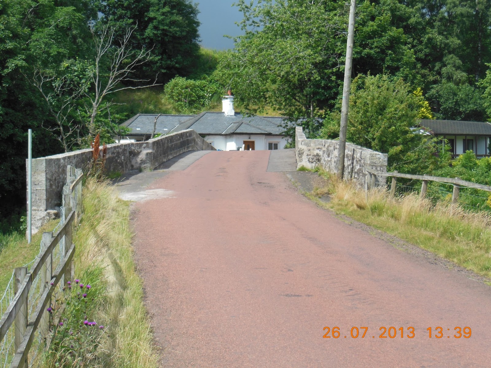
Meltoun Bridge over the Tweed
 After turning off Dere Street it was down to the Tweed valley shortly after Maxton. There Irvine left me to make his way to the Buccleuch Arms hotel (and a welcome sandwich and beer), where he was to be picked up to go back to Jedburgh for his car. My route then took the pretty way, following the Tweed around a great bend to reach a point not more than a quarter mile form where Irvine had gone to meet his taxi. This is a beautiful stretch of water, with what are obviously fine pools for salmon. Nobody was fishing, though: the Tweed is, I think, essentially a late river, and in any case the water was pretty low. In these conditions I would certainly hesitate to invest the several hundred pounds a day that a good beat on the Tweed costs. I’d want to know there were fresh-run fish.

Dryburgh Abbey Hotel from across the Tweed
The point where I finally left the Tweed was directly opposite Dryburgh. The Hotel where we’d eaten a couple of days earlier was clearly visible, but the Abbey was still hidden behind trees.

The distinctive Eildon Hills from the East
As with the Pennine Way, St Cuthbert’s Way never takes the easier options, so instead of a more direct route to Melrose it crosses the Eildon Hills. These are three rounded peaks, not particularly high, but isolated and visible for miles. The path goes inland to the attractive village of Bowden, and the climbs up through woodland to cross the hills by way of the col between the Middle and North Hills. Then it’s a fairly steep descent into Melrose itself. I arrived half an hour before the appointed time, but the coffee shop near the Abbey was already closing at 4:30. I don’t begin to understand. This was the tourist season; people were leaving the Abbey as it closed; surely there would be customers? Or has enterprise died in the Borders?

Irvine met me at Melrose, having visited Mellerstain House and Floors Castle. Mellerstain is the work of William Adam and his son Robert, and has some of the finest Adam interiors, which Irvine had long wished to see. However, he reported that it now seems somewhat run down, no doubt through lack of money. Irvine hadn’t had time to go into Floors Castle, but the building itself – Scotland’s largest inhabited castle – is quite magnificent. It’s one of the principal Roxburghe properties, further evidence of how the Kers, as former Border reivers, benefited from ennoblement after the Union.

The view over Melrose from the Eildon Hills
We drove back to our B&B. Irvine reported that the Buccleuch Arms seemed to have a good restaurant, so (with confirmation from Tripadvisor) that’s where we went for our last dinner in the Borders. Excellent starters, excellent steaks, and reasonably priced, so it exceeded expectations.

I was interested to know what Irvine’s ambitions now are. It seems that they very much revolve around the schools he is supporting in Newcastle. They’re really making a difference, and are improving outcomes significantly. He supports a secondary academy, divided into four separate units, and more recently has become involved with three primary schools, so that kids are helped even before they reach secondary level. There is a rigorous system of measuring teachers’ performance through added value, and excellent management. He is a great believer in making sure that kids from hugely disadvantaged backgrounds aren’t handicapped by starting the day hungry, so they provide breakfast. For later in the day they provide what he believes is the best school food in the country. This is supported by his own experience when eating there.

Irvine had talked with one of his friends, also a major philanthropist with an interest in schools, about when he could expect to achieve his objectives. The answer is – never. Once one starts to support a school there is no limit in time or cash as to what can be done. One of the issues he is now facing is how to manage his schemes. He has an excellent former headmaster working for him, but he is much the same age as Irvine, and succession is likely to become an issue. I suggested that management training for good teachers might be necessary, which got Irvine thinking that it might be something he should discuss with Michael Gove as an area where he could also contribute.

Irvine and the Welsh Cob in Jedburgh
On the way back into Jedburgh Irvine spotted a horse rolling on the roadside verge; nearby was a colourful tinker's caravan. We spoke to the chap in it, who had seen us with his (as it turned out) Welsh Cob. They had made their way from Cornwall, had sold a horse at Appleby in Westmoreland, and were going on to Brighton and then to the Camargue. Afterwards I wished we had interrogated him further. Does he have a home, or is the caravan it? How does he finance it? How do you get a caravan and a couple of horses across the Channel? How long has he been doing it? And many more questions that sprung to mind afterwards. We mentioned our discovery to Walter and Jean, and suggested that they might get a local journalist to find out more. I shall be interested to find out if they succeeded.

Walter, Jean and Irvine
The following day we were up early, and drove to Edinburgh airport where Irvine had left his Gulfstream 550. My week’s walking was rounded off in style by being flown in his plane back to Northolt, from which Irvine was to go to Cliveden and then to Mozart’s Die Entführung aus dem Serail (Il Seraglio) at the Garsington opera – now at the Wormsley Estate, which used to be one of my favourite walks when my parents lived nearby in the Chilterns. He expected to be lobbied to contribute to Garsington as he does to the Royal Opera, ENO and Glyndebourne.
It had been an excellent seven days of walking, with splendid company, and except for one horrible rainy day, pretty reasonable early summer weather.


Cloudy but dry. 13-16C. 24.5km, 534m ascent and 544m descent. Maximum height 318m in Eildon Hills. Mostly good footpaths, but about 15% on roads.