Tuesday, 26 May 2015

Tain to Dornoch

We had spent much of the previous day – notionally a rest day – taking John Poulter to Inverness Airport, hanging around there, and collecting Richard and Niki Dale from their easyJet flight. On the way back to Tain we showed them the dolphins at Chanonry point (an excellent display, with many salmon consumed) and some of the Black Isle.

Myself, Niki and Richard Dale - ready for the off
from the Carnegie Lodge Hotel
This was the first of the three days Richard and Niki were to accompany me. It was not a promising start: the forecast was for showers and generally low temperatures. It wasn’t actually raining as we started, but it certainly felt as if it might soon.

The initial stretch was down the minor road that runs past the hotel, and then a short length of the A9 as it bypasses Tain itself. The previous day I had noticed a sign pointing towards the Pictish Way, which seemed actually to indicate the beginnings of a path. But the Pictish Way is actually a tour of various Pictish stones, not a walking trail, and what had seemed the beginnings of a trail was in fact a defunct bit if old road. So we had to retrace our steps. 

The next approach to A9 avoidance was to see whether we could get down to the shoreline of the Dornoch Firth. This too proved fruitless: no way to cross the railway, and some new structure jutting out into the Firth from the Glenmorangie distillery half a mile to the West.

The omnipresent A9 before crossing Dornoch Firth
So the A9 it had to be, at least for a while. But there was a minor road off it to the South, and the map seemed to show a series of connecting tracks that should get us back to the A9 just before the Dornoch Firth bridge. And so it proved. Getting away from the A9 was a great relief: it wasn’t as busy as it had been the previous day with bank holiday traffic, but it was still a daunting prospect to walk along it for any length of time. Even worse, you can hardly hear one another over the noise of the traffic.

Our alternative took us past a few scattered houses, then what increasingly appeared to be the driveway of a large house. This proved to be the case – Tarlogie House, according to the map, with well-maintained lawns. Just as we had that sinking feeling that we’d have to retrace our steps and find some other way through we were lucky enough to find a well-established footpath, not marked on the map, but going exactly where we needed. After that it was an easy gravel road down to the roundabout where the A9 turns North to cross the Dornoch Firth.

The worst is over: looking back at
the Dornoch Firth bridge on the A9
This was the truly horrible part of the walk. The road doesn’t have any proper footpath, just a white line a yard or so from the edge which is supposed to indicate a cycle track, and then a couple of feet of granite chippings on the causeway before the bridge, which becomes a narrow raised pavement where the bridge itself starts. The traffic is approaching at 50 mph or more, and anything larger than a car produces a real shock wave of air. And just as we started the 1 km or so of the bridge itself the rain started – driven rain on half a gale of wind. The only minor redeeming feature was that we were on the East side of the bridge, facing oncoming traffic, and the wind was from the West – i.e. from across the road, blowing us against the railings, rather than the other way around.

Reaching the other side was a huge relief. We were able to clamber down the steep bank at the end of the causeway on the North side of the bridge, and follow a track for parallel to the road until we reached the minor back road in to Dornoch. This was through the burnt skeletons of old gorse with new growth beneath in vivid flower, and areas of heather. Just before the road itself there were plantings of new broadleaf trees as well. And just as a final reward the rain and wind abated. It was almost as if their earlier intensity had been a test.

The bank along the minor road into Dornoch
The last bit was a straight walk of about 5 km in to the centre of Dornoch. All very level, just a foot or two above the level of the sands in the Firth, and really rather attractive. Banks of gorse; lots of bluebells; larch and pine woods; horses and sheep, some with and some without their (mint sauced?) lambs; occasional houses; a series of fishing lakes; a driving range. The banks on the inland side of the road were extensive, an about 6 or 7 metres high. They looked man-made, but I can’t imagine why anyone would want to build them. They were hardly continuous enough to be sea defences, and in places seemed to head off inland. Very strange.

Dornoch Castle
We were slightly delayed by Richard and Niki having to tackle issues at home: a painter turning up at their temporary home a week before the appointed time. I think it slightly spoiled their day to have to make a number of phone calls instead of enjoying the last bit of the walk.

We arrived at the Castle Hotel before 1:30, so it was a late lunch before R&R in the afternoon.


Cloudy, cold, with occasional rain and even more occasional brief glimpses of blue sky and sunshine. 9 to 14C. 14.14 km, largely level – only 55 m of ascents and 112 m of descents. Some on A9 verges, some on tracks, but mostly on minor roads.

Sunday, 24 May 2015

Kildary to Tain

Stuart and Elinor had eaten with us the previous evening, but had stayed at the Royal Hotel in central Tain, as the Carnegie Lodge was fully booked with cyclists on their way to John O’Groats. In any case, the previous day had been their last, so only John and Susan were available to accompany me. Susan had a blister in the ball of one foot and an inexplicable black big toe on the other, so it was just down to John and myself.

The view down over the Firth of Cromarty
This was to be a short day, since we could start from the point in Scotsburn (or was it Marybank?) where we’d turned off for Kildary the day before. So it was a simple matter of getting Susan to take us back up the road from Tain, after which we would just go back down the same route. All rather silly, it seems in retrospect, but my objective is, after all, to walk the whole way from Land’s End to John O’Groats.

The road from Scotsburn to Tain starts by passing a series of detached houses in an area, according to the map, called Lamington. These are nearly all fairly new and large, with expensive cars parked in their driveways. Lots of horses, too. So presumably they’re largely residents’ houses rather than holiday homes. It’s difficult to understand why this area is so apparently affluent. 

A smartly dressed local resident.
Perhaps it was the offshore oil industry that brought wealth to the area: if so, they must be suffering now given the recent downturn of the North Sea now that the fields are depleted and the price of oil has collapsed. I’d thought that it was Aberdeen that got the lion’s share of the wealth generated by the industry, but it must be more widespread. Nigg, after all, has a lot of offshore related industry, and so too must Invergordon, and there are half a dozen or more oil rigs moored in the Firth of Cromarty.

After this it was a stretch through woodland, where we were offered the alternative of paths to the North. We could have taken them had we wanted to extend the walk, but our preference was to get back early and do some local exploring for the rest of the day.

The wooded part of the walk back to Tain 
The final stretch into the outskirts of Tain were through farmland and then a number of houses far less grand than those we’d passed in Lamington. And then it was through the housing estate outside the A9 bypass, and back to our hotel only a little after 11:00. There were a few spots of rain as we approached the A9, but otherwise it was largely a bright and pleasant morning’s walk. And the time passed even more rapidly given the excellent company provided by John Poulter.

With the walk taking only half a day there was time to go in to Dornoch to see the cathedral and have lunch, and then to explore the coast as far North as Brora. Which was just as well, as it gave us an opportunity to see the Sutherland Inn in Brora, which is right on the main road. Further research suggested that this had declined to a dramatic extent, so we were able to cancel our booking and get in to what seems like a much more satisfactory alternative.

We shall see!


Bright, but with a fair amount of cloud, and occasional few shower. 12 to 15C. 7.51 km, largely level – only 41 m of ascents and 68 m of descents. All on minor roads.

Saturday, 23 May 2015

Dingwall to Alness

Yesterday was change-over day: Rosemary and Alan away to the South, and John Poulter, and Stuart and Elinor Goldsmith, arriving on the flight from Gatwick to Inverness.

Dolphin watching
Actually that’s rather over-simplifying things. In the morning Susan and I went to Chanonry Point to watch the dolphins, and were there with Rosemary and Alan (and 100 or so others) to witness a tremendous display of ten or more dolphins, including a mother and calf performing synchronised rolls not more than 20 meters from the shoreline. Then we managed lunch together in Cromarty before we had to head back to the hotel in Muir of Ord to greet our new walking companions.

We came across John half way along the drive to the hotel. His taxi had delivered him to the wrong hotel, and he’d already walked most of the mile and a quarter between the two hotels before we were able to rescue him with a lift for the final few yards. He had missed Stuart and Elinor at the airport, and they had been forced to wait for a hire car to arrive on a transporter before setting off to meet us. However, all were duly assembled, and after a brief walk around the block and an excellent dinner we were all set for the walk on the following day.

So in the morning it was an early breakfast, and then off to catch the 9:16 train to Dingwall. This was over-heated, but it was only ten minutes to take us to the point where I had finished the previous section with Rosemary and Alan Towers a couple of days earlier.
More gorse

So it was back up the High Street (a little more lively than when Susan and I had been there two days earlier, but still showing the negative impact of the huge Tesco on local businesses), and then up a hill to get to the minor road that runs parallel to the main road to the Northeast. The town continues for some way along this road, with the houses getting obviously newer as one gets towards the countryside.

After this it was actually quite a pleasant walk: even though it was all on the road, there was little traffic, so we were all able to walk side by side in groups of two or three for most of the time. The first part was gently uphill, but then there was a relatively level stretch before dropping back down again. It was very pleasant to have a larger group than usual. One can change ones walking companion form time to time, and get to spend time with everyone else.

Oil rigs on the Firth of Cromarty
And the views were great. 100 meters above sea level provided enough elevation to have wonderful vistas over Cromarty Firth, changing with the state of the tide, and across to the Black Isle, with its patchwork of fields, several of rape still in fine yellow flower. To the Northeast there was a series of oil rigs moored in a precise line between Nigg Ferry and Invergordon.

An easier alternative?
About half way to Evanton we came across a group of cyclists having a rest break, with their support van in attendance. This was emblazoned with pictures and advertising, including mention of the Land’s End to John O’Groats challenge. That was what this group were doing – and they were on the penultimate day of fourteen. It meant that they had to cycle 60 or 70 miles a day. I thought that this must make anyone saddle-sore, which was rather borne out when I saw one of them standing on the pedals when freewheeling downhill.

Stuart knew this part of the world quite well, as until seven or eight years ago he had owned a chunk of forestry in Glenglass. He assured us that there were a couple of pubs in Evanton, though I was suspicious, given that there was no blue tankard on the map. But he was right, so after not more than a few seconds’ hesitation we went in for a break – and drinks all round. This was a welcome break. Though the weather forecast had promised improving conditions as the morning progressed, the reverse proved the case, and it had become quite chilly and was beginning to spit with rain as we approached Evanton.

The easier way back to Muir of Ord
This was also the point at which Elinor and Susan finished their day’s walking, and caught a bus back to Dingwall. For Stuart, John and myself it was back to the road (rain finished), sandwiches in a bus shelter (better than sitting on someone’s garden wall) and the final three or four miles to Alness. Initially this was on a high quality cycling track that parallels the road and runs through pleasant woodland, but the last mile into Alness itself was along a dead straight road with no redeeming features and plenty of traffic. The only consolation was that there was still a cycle track, even if it was more like an ordinary pavement.

Then we were in luck: the timing proved perfect to catch a bus back to Alness, from which we could catch a connecting service back to Muir of Ord. So we were through the day’s walk and comfortably back in the hotel by mid afternoon.


Initially bright, but becoming more cloudy as the morning progressed, and a little light rain at lunchtime. Brightening in the afternoon, and sunny as we finished the day’s walk. 12 to 16C. 17.95 km, 150 m of ascents and 136 m of descents. Minor roads for most of the journey, though a little of the final stretch was on a walking/cycle track that runs parallel with the road.


Friday, 22 May 2015

Alness to Kildary

The walking party, 23 May, at Ord House Hotel
Tom, Susan, Elinor, John and Stuart
This was a moving day, so it was time to pay our bill (how did they manage to make mine exactly £999.90?) at the Ord House Hotel, and move on to Tain. Susan and Elinor drove the cars, dropping Stuart, John and myself off exactly where we had finished the previous day, before driving on to Tain. The plan was for them to join us for lunch and then finish the day’s walk at Kildary.

So we set off in fine weather, first of all to walk for a mile or more through Alness itself. The town has a grand, wide main street, and a few large 19th Century houses in the centre. But most of the fringe of the town is much newer, and we
Alness - a handsome centre
finished up the urban part of the walk going through an estate under development, with a dozen or so rather ugly “executive homes” at various stages of completion. It’s all rather surprising. Scotland’s population is not, as far as we know, on the increase, and peak oil is history, so why is so much housing in these towns so new? Research required.


At last we were out of Alness itself, and on the minor road to Mossfield. This was the start of what I had planned to be one of the two off-road parts of the day’s walk (although in the event it was the only one). It started with a grassy track between two houses, a kissing gate made of plyboard with scarcely room to squeeze through, and then a few hundred metres of muddy track through woodland. It meant rougher going, which we all found a little more tiring than road walking, but it was certainly more enjoyable.


A continuous roll of silage. How do they do this?
Then it was open fields, inspected by a series cows – firstly a field of yearlings, then by one of heifers and their first calves. The final bit was along a track leading to what must have been a haulage contractor’s business, with abandoned trailers in the field and along the lane. I never cease to be amazed by the amount of junk that gets left in so many farms. Farmers may expect walkers to observe the country code, but they seem to ignore it themselves. 

The next stage was a long, steady uphill haul - just the sort of gradient that seems easy but actually takes some effort. To our left was a field of rape in full bloom, now stinking with overtones of cabbage; to our right there was what is obviously a major riding establishment, complete with a covered manège and extensive stabling. There were also several holiday cottages, which underlined the fact that this is a major operation. As Stuart and John commented, it’s probably more profitable than farming. And shortly afterwards we came across an area where flags were flying around a paddock, and a field was being marked out for parking. Presumably some major horsy event was due to take place over the bank holiday weekend, thought there was no signage explaining what it was to be.

The hope that we would meet up with Elinor and Susan by noon had obviously been wildly optimistic. It was already close to 12:00 and we still had more than two miles to go.  Frequent exchanges of phone calls kept putting the time back. But at least it wasn’t only my optimistic assessment of how long it would take: Elinor and Susan had been dropped by their taxi well short of the intended meeting place, so had to walk more than a mile themselves.


Bog cotton
Our final bit was something of a route march, mainly along what the map showed as woodland, called Badachonacher Moss. What OS maps fail to show, of course, is the maturity or otherwise if woods, and it turned out that much of this one was clear felled. My original plan had been to take forest tracks through it, but that was no longer sensible. It would have added another half mile or more to the journey, and besides it wasn’t woodland any more.

Although the trees had all gone, leaving large areas of moonscape, they had left a few trees at the roadside, and the felled area had the most extensive and dense growths of bog cotton I have ever seen. I remember lots of bog cotton from the Pennine Way a couple of years ago, but this was much more remarkable.

We actually managed to walk past the point where Elinor and Susan had found a picnic table, and they had to call us back. It was now much chillier, so our lunch didn’t detain us long. Then it was the final stretch, downhill pretty well all the way to Kildary.


The most intense gorse yet
Gorse had been widespread before, including extensive borders along roadsides and forest edges, between fields, and even large areas of hillside. But the road down to Kildary and the journey on to Tain was of a different intensity altogether. Here the gorse was at its flowering peak, with the blooms so dense that bushes seemed entirely yellow. This must be one of the most gorse-intense areas in all of Scotland – though there is certainly no shortage elsewhere.

We called for the taxi that had taken Susan and Elinor up to meet us, and it collected us from Kildary after no more than a few minutes wait. So we arrived at our next hotel, the Carnegie Lodge in Tain, by early afternoon.


Bright, but with a fair amount of cloud, and occasionally chilly in the wind. Better later in the day. 14 to 18C. 18.55 km, 260 m of ascents and 232 m of descents. Minor roads for most of the journey, apart from one two-mile section through woodland and fields.

Wednesday, 20 May 2015

Muir of Ord to Dingwall

This was to be the last of the three days with Alan and Rosemary Towers. They would be going back down South for the weekend, but returning to accompany me for the final two days early next month to John O’Groats itself.

Rosemary and Alan on the Black Isle
As the crow flies – and by way of the main road – this is only about 9km. But the direct route didn’t appeal, so we manufactured a route by way of minor roads to the East of the main road, and then crossing the river on the main road (there is no alternative) and a final stretch of a mile or so into Dingwall itself.

Muir of Ord has a splendid name, but not a splendid nature: it’s actually a rather plain little town. A few older houses in the centre; an industrial estate with huge buildings on the road from Beauly; lots of newer estates on the fringes; and major new building projects offering new 2 or 3 bedroom houses at “from £100,000”, or at £365 per month with Help to Buy support. It still seems incredible that for the price of our flat in London we could buy ten houses up here. Such is the law of supply and demand.

It’s not even as if this is a particularly impoverished part of the world. Indeed, it seems quite prosperous. There are a lot of relatively new homes in the area, many very substantial, and plenty if other signs of prosperity. Of course, it’s pretty close to Inverness, so presumably a large proportion of the local population commutes in to town. But I shall leave this as conjecture: I don’t plan to study local traffic movements early in the morning.

The rabbit warren between two fences
Our route took us on minor roads through areas called Balvaird and Newmore. You can’t call them villages: they have no focus, and simply comprise 30 or 40 separate dwellings, each with a house name and a number – 19 Balvaird, for example. Once again each seemed to have a smallholding of 10 acres or so. All are pasture, most with a few sheep, and several horses. The sheep included a pair of totally coal-black animals with white flashes on their faces – something I’d never seen before.

The route involved regular right angle turns, and in an attempt to avoid walking three sides of a square on one occasion we tried to find a track where none existed. Two parallel lines on the map, the distance apart that would appear to indicate a track, represented what were in reality fences – and the area between was a continuous rabbit warren. I was prepared to cross the barbed wire, but Rosemary and Alan declined, so there was some inevitable retracing of steps.

Descending back to river level
Our progress was watched over by a pair of red kites. We saw them frequently, and initially thought there must have been more than two, but we never saw more than the two at one time, so presumably they were just quite wide-ranging. I hadn’t realised there were red kites up here: Galloway, of course, but not here. Were they evidence of another scheme in this part of Scotland, or wanderers from elsewhere?

After few kilometres on the heights of the Black Isle we came across a sign post pointing to Conon Bridge. Some careful map reading suggested that we could take this route, and after half or mile or so on the main road would be able to walk down to the river and along its bank to the bridge. And so it proved: a delightful riverside walk, mostly through woods that flank the river, and finally across a little open ground in to the town itself.

The River \Conon in flood
The Conon was in boisterous mood, flowing powerfully and probably two or three feet above tis normal level. But it’s surprisingly clean with such a big flow – clear, with no sign of the discolouration that happens with so many rivers in spate. No wonder the fishing in these rivers is so highly rated. Though perhaps not by the two fishermen we saw just below the bridge: the water, one said, was too big, and besides this part of the river would be at the top of the tide in just a short while.

The final part of the walk was through the town of Maryburgh and along the road into Dingwall itself. Fortunately there was a cycle track parallel to the (busy) main road, so we weren’t as exposed as I’d feared over this last stretch. But Rosemary and Alan put on their long league boots, and I found myself a hundred metres or more behind them before they noticed and waited for me.

The rail bridge over the Conon in Maryburgh
Then there was time for a quick coffee at the station tea room before catching the train back to Muir of Ord. As a final treat Susan was able to meet us there so that we didn’t have to walk the final mile back to the hotel.


Bright for most of the day, but with cloud building progressively. Much warmer than recently – 11 to 16C. 12.66 km, 221 m of ascents and 266 m of descents. Minor roads to start, then riverside path, and final 3km along A862.

Tuesday, 19 May 2015

Kiltarlity to Muir of Ord

The Post Office at Kiltarity
We were away from Woodlands Guest House early, and able to check in to our rooms at the Ord House Hotel before our taxi picked us up to drive back to Kiltarlity. We started our walk at about 11:15 – a lot earlier than if we’d organised transport ourselves with cars at either end. And taxis up here seem to be very reasonably priced.

The first part of the walk involved retracing the route taken by the taxi, along the B road that skirts the Beaufort Castle estate and crosses the River Beauly at Black Bridge. I remembered this exact point from 45 years ago, when Susan and I had visited the bridge and the power station above it, and watched fishers below and salmon themselves being raised through a lift within the power station dam.

The River Beauly at Black Bridge
There were fishers here again today, and I spoke to a woman who was carrying her rod back across the bridge, complaining about the difficulty of casting with the current wind strength. No fish today, but the previous day had produced a number. This is one of the very best (and most expensive) beats of salmon fishing in all of Scotland.

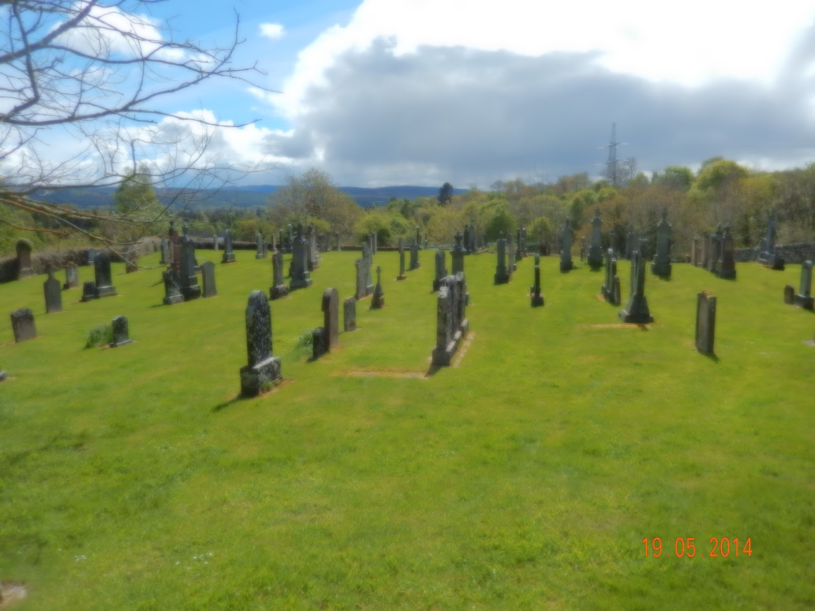
Kilmorack Cemetary
After crossing the river we went a few hundred yards up the major road to Cannich, and then struck off to the North at Kilmorack. The next part of the walk – and about two thirds of the total – was on minor roads between Kilmorack and Muir of Ord, passing to the West of Beauly. This is a strange area of tiny fields, typical of crofting country to which the tenants were relocated during the Highland Clearances. But the buildings are mostly modern – so the original crofts must have been replaced over the years, and the whole area has been transformed from one of poverty to what feels like a middle class enclave. There was building going on, and nearly everything looked very smart and well maintained.

There is a series of largely parallel roads as you go up the hillside, with the top road at the 170m level just below the forestry. Much of this has now been felled, and up here it seems that they’ve actually grubbed out the roots and levelled the ground, so presumably gentrification is continuing. There are certainly splendid views across to the Beauly Firth and the Black Isle.

The hills before Muir of Ord - 
with the Firth of Beauly in the distance
We stopped for lunch at the high point of the road, where someone had conveniently built a stone wall at the ideal height for sitting. At least today’s lunch stop was dry. Then it was a winding road down to Muir of Ord, past more evidence of gentrification – a field of Shetland ponies, someone having new windows fitted, several smart new houses. This is a part of Scotland I had never visited before. The coastal strip is flat and fertile, and the towns almost join one another – Beauly, then Muir of Ord, and on the Conon Bridge and Dingwall. The roads seem pretty busy, and there are industrial estates and distilleries and all sorts of other businesses.

The ubiquitous gorse
The final bit of the day’s walk involved going along roads that were essentially three sides of a square. The fourth would have been quicker, directly to the hotel, but it proved not to be as straightforward as I had hoped. The wooded area marked on the map as Birch Wood was recently clear-felled, and there was no obvious route across it.

We arrived back at a little before 3:30, with Alan and Rosemary planning to visit the Ord distillery next door, and me to await Susan’s arrival. That turned out to be later than anticipated, because Easyjet had to eject a drunk from the flight before it could leave – so eventually it had left Gatwick at the time it had originally been scheduled to arrive in Inverness.


Cool but bright for most of the day, though with occasional showers. 9-13C. 15.6 km, 294 m of ascents and 268 m of descents. All on minor roads.

Monday, 18 May 2015

Drumnadrochit to Kiltarlity

Alan and Rosemary Towers
This was the eagerly-awaited resumption of the walk, complete with my new bionic left hip. Though it was also tinged with an element of apprehension, given the stiff uphill trek involved after a long layover. It was to be a three-week hike ending in John O’Groats. Alan and Rosemary Towers were joining me for both ends of this final drive, and like me had driven up to Drumnadrochit the day before.

After an excellent dinner, a very comfortable night at the Woodlands guest house, a hearty breakfast, we were on our way just before 10:00. We had elected to leave both cars in Drumnadrochit and take a taxi back, though Alan did take his into Drum itself, as it seemed silly to repeat a mile or more of what we’d done on the last day of walking in 2014.
View back across Loch Ness from part way up
 the Great Glen Way

The first part of the GGW out of Drum is along the A82. There is a pavement, but it’s only a metre or so wide, and the traffic is doing the best Part of 60mph as it thunders past. It’s a busy road, so the traffic has to stay close to the side. This means that, particularly if two of you are walking side by side, vehicles are less than a metre away. I found it pretty scary, even though it was Alan rather than me nearer the traffic, and I was thoroughly glad to finish the two miles.

The first off-road bit involves a short climb, a bit on the level, and then back down again - simply to get round a private house and garden. Then it does start the real ascent, although a diversion (lambing, we presumed) means it’s level and then sharply up instead of gently up across a field.
After that it’s a long steady climb through dark spruce woodland. The ground is surprisingly green given the lack of light, with shamrock (small white flowers as well as the emerald leaves) and moss. We’d been going quite a while when I first looked at my altimeter, only to discover that we’d climbed a mere 100m. Clearly out of practice. At the first water stop we were passed by a young man who had probably done the same as us in half the time.

The later stages through woods are gentler, on an old forest road originally put in during the war, when Canadian lumberjacks were brought over to produce more timber. Apparently a number of them also married local lasses, which can’t have made them popular with the Jocks away at the war.

Then there’s a stretch across an open, heather-clad area, with wonderful views now of the Northern end of Loch Ness. But it wasn’t long before we were re-entering the wood for a final climb (to almost exactly 400m) before descending fairly rapidly to meet a track which runs more or less straight SW to NE. It was at these points where we finally met other walkers coming from the Inverness direction, but they must have either made much better time than us as they would have had to travel twice the distance, or started some way in to the walk.
Another Loch Ness view from higher up the GGW

We took our lunch break at the point where we left the GGW. Sunshine on the hillside opposite, but rain for us. Then it was all road walking – quiet, but still the occasional car. The trees on the edge of the woods were incredibly festooned with lichen – not only completely covering their trunks, but also hanging in great tresses from their branches. Most were oak which isn’t in leaf this early up at this latitude and this altitude, but one wonders whether there’s any room left for leaves. This was the point where the hail started. We’d seen the huge grey cloud approach, but initially it had seemed it would miss us. But it was not so. Fortunately it didn’t last long.

The open area towards the end of  the GGW
We were still high, and with brightening weather there were spectacular views in a great arc from the North, through the West and down to the Southwest. The higher peaks were still snow-covered: apparently there had been more snow at altitude overnight. The peaks sparkled when struck by the emerging sun. There were now occasional farms, increasing on frequency as we dropped down from the top, and a writing centre for people who get a week’s course tutored by a named (usually Scottish) writer. Then it was across the Drumnadrochit to Beauly road, and a mile and a half or so to Kiltarlity. Our maps lied. No pub, but the Post Office/store ran to coffees, so we were able to have refreshments while we sheltered from the rain waiting for our taxi.

Still snow on the mountains to the West
A good day’s walking, even if I was rather stiff by the end of it. A little too much of it was spent 20m or so behind Alan and Rosemary. I seemed to find myself trailing whenever I paused for kit adjustment, to take a photograph, or to check out a bird. But it does stop me from dawdling too much.


Dull for most of the day. Rain mid-morning, and intermittently thereafter. Continuous hail for a period in the afternoon, and then fair. Rain again after we had reached our destination. 9-14C. 19.0 km, 540 m of ascents and 500 m descents. Road (A82) out of Drumnadrochit for the best part of a couple of miles, then paths and forestry roads until we left the Great Glen Way to make our way down minor roads to Kiltarlity.