 |
| Old bridge over River Oich |
After
an excellent breakfast Neville took us back from Drynachan to the swing bridge
at Aberchalder where we had finished the previous evening. This is a
picturesque place, with the old bridge over the River Oiche and a vista over
the mountains to the East.
The
Shortly
after starting long he towpath we met a Scot walking towards us, and stopped
for a chat. His T-shirt mentioned some expedition involving Munros; on enquiry
he said hat he’d done them all. I think they now number 283, so it’s an
impressive achievement. Particularly in his case, I felt: he was short and
stocky, not the sort of lean and fit character I’d associate with hill walking
– or mountaineering, for that matter. After all some of the Munros require real
rock climbing, and walking along narrow ledges where a slip could prove fatal.
I think it’s a little late for me to start on them now! I’ve managed Cairn
Gorm, but only from the cable car station, so even that doesn’t really count.
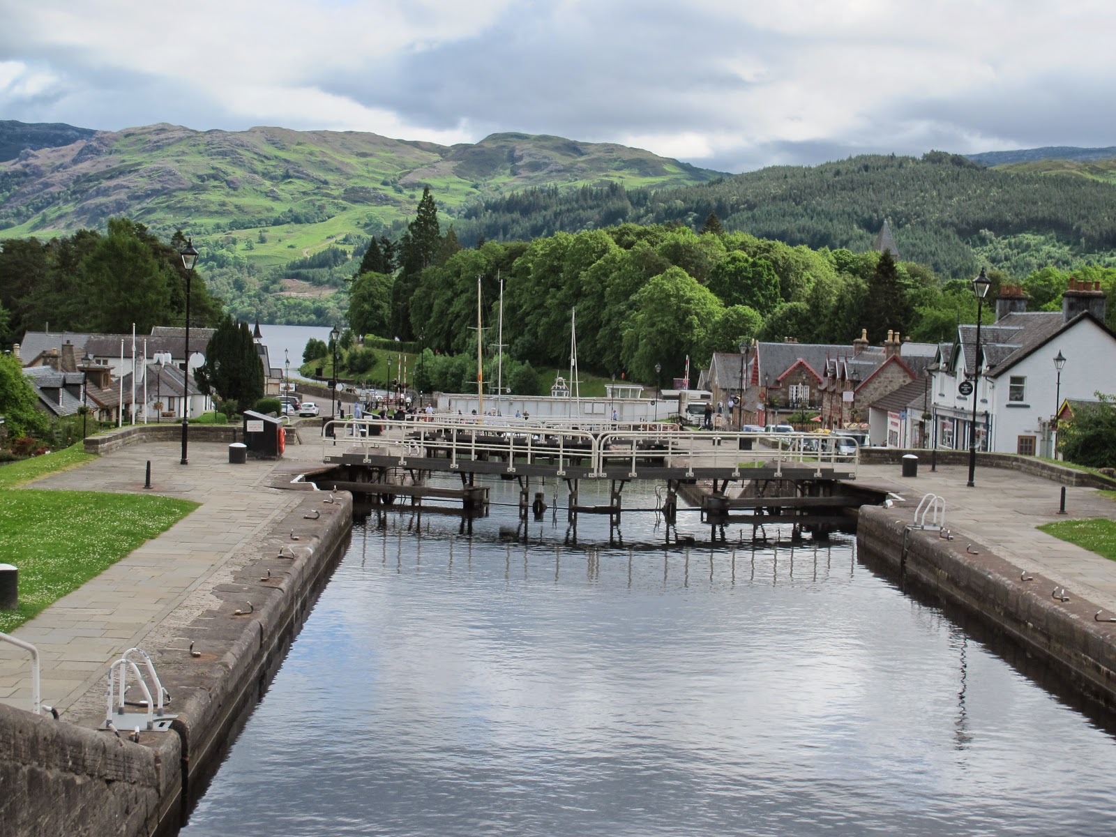 |
| The flight of locks at Fort Augustus, carrying the Caledonian Canal down to Loch Ness |
It’s
all easy walking for the five miles to Fort Augustus
 |
| Alan, Rosemary and Tom in front of the Loch Ness Monster |
It
was then time to head into the woods. After skirting the Northern end of Fort Augustus Loch , but there are a couple of
areas of clear fell where there are excellent views. The Loch
is over twenty miles long, with steep sides, so it’s an impressive area for
views. It could have done with more sun to light up the views, though.
 |
| How to keep midges out of your lunch |
We
stopped after an hour or so to eat our sandwiches. Midges found us immediately.
Rosemary is particularly wary of them, so it was on with her anti-midge hat
which sports a full veil. It’s not the easiest apparel for eating a sandwich,
but she managed it somehow. Alan and I stuck it out: perhaps we aren’t as
sweet.
When
ever I stopped to take a photograph I’d find myself 20 metres or so behind Alan
and Rosemary. It could also happen as we were walking along. Their natural
walking pace is marginally faster than mine, so I seemed destined to drop
behind when we were not actually engaged in conversation. Their rears become
familiar sights!
One
of the areas of clear felling was recent, and though nobody was working as we
went past there was still a range of heavy equipment in place. There were huge
piles of logs waiting to be transported, marked with their lengths and
indicating whether they were for pulping or for timber. Fortunately we didn’t
encounter any logging trucks, so it was a peaceful if rather desolate scene.
The
track carries on past the point where the descent to Invermoriston would be
shortest, so we had to carry on for another half mile or so before we were
offered a descent. This was through an older area of clear fell, and meant that
we had to walk back to the main road – still the A82 – to cross the river into
the village.
 |
| On the old bridge at Invermoriston |
There
is a very picturesque old bridge just above the main road bridge, where both
cross a series of falls and rapids on the River Moriston. So it was a short
rest and photography stop before the final half mile into the centre of
Invermoriston. Not that it’s much of a place – a few houses, and a hotel and a
very basic village store at the junction of the A82 and the road that leads to
the Isle of Skye .
The
B&B, strangely named Craik na Dav, involved a short climb out of the
village, and the two sisters who run it welcomed us with tea and cake. So it
was a shower, rest, and then a trip back down to the hotel for dinner. This was
rather better than the previous day, fortunately.
Cloudy with
occasional sunny spells. A little rain early afternoon. 15-19C. Easy going on
canal path and good tracks; minor road walking in Fort Augustus
No comments:
Post a Comment