Saturday, 18 February 2012

So far, so good ...


The Starting Point ...

I've now completed the first week!
No blisters, no cramps. I haven't lost any weight, though: or have I put on more muscle to replace those fatty pounds?
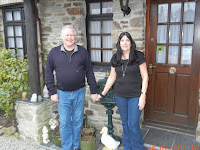
It was great walking, and great company - Brian and Jill Rowson for a couple of days, and Richard Dale for the next three.
Most of the time it was the South West Coast Path, with only a couple of minor diversions. It's largely cliff-top walking, with a churning sea often 100m or more below. There were also the great sandy beaches of Northwest Cornwall, with endless breakers. There weren’t many others on the walk at this time of year, but surfers and kite karters were already out and about.
The only downside was the weather. Sunshine only on the first day, and then nothing but the odd fleeting glimpse. And for most of the time there was a brisk Northerly wind right in one's face. But it was February, after all, so maybe that should have been expected. At least it didn't rain. February filldyke it was not. Hosepipe bans loom.
... and where I've got to so far

Total distance travelled worked out at 129km, or a little over 80 miles. My Timex watch/ chronometer/ altimeter says that ascents totaled 3,210m (about 10,000ft). I think that may have been a bit of an exaggeration, but not by too much.
At least I know I can do it. I’m looking forward to the next couple of weeks, starting at the end of April. (Works at home to monitor first, and then a couple of weeks on the other side of the Atlantic.) Some of the stretches are even more up-and-down than those I’ve already done, so it may be rather testing.
We shall see!

Thursday, 16 February 2012

Crantock to Mawgan Porth


Looking back from Newquay across the Gannel to Crantock Beach

Richard had elected to get back to Polperro earlier than originally envisaged, and to do so by public transport rather than getting Niki to pick him up. So we parted after a very good breakfast – he to catch the 10:13 train (generously driven to Newquay station by Bernard. I was away by 9:20, leaving my case to be taken to Newquay station later in the day by the incredibly generous Bernard.
The walk out of Crantock was a pleasant cross-country stroll – initially more uphill than expected – to the Gannel tidal crossing. Fortunately we were on neap tides, and it was still two hours before high tide, so the footbridge was easily accessible. Then across the Western end of Newquay to Fistral beach, which I crossed on the sands to the Surfing development at the far end. Surfers already in evidence, including a couple of boys, no more than ten or so, obviously about to have their first lesson.
Then it was round the former hotel near Towan Head – now being redeveloped, presumably as apartments, and a relatively easy walk into Newquay proper.
Guess who?
This was the least attractive part of the whole walk from Land’s End. Newquay is not an attractive town. I had expected golden sands as elsewhere on the coast, but at high tide very little was evident. There are cliffs all the way, and even if they are largely fairly modest, they make it much less of a seaside resort than I had expected. There are lots of surfing-related shops, amusement arcades, and the town as a whole has a general air of being rather run down. Maybe it was just because it was February, but I was not impressed.
After the final bit of Newquay, Porth Beach, things improve. Trevelgue Head can be avoided by keeping to the road, but it is worth the extra few hundred metres. And after that the SWCP gets back up to scratch.
The two miles or so to Watergate are reasonable cliff-top walking, with the fields under RSPB management for corn buntings (though I didn’t see any). Watergate itself is obviously being significantly enhanced with much new building, and is clearly becoming a major surfing centre.
Watergate Beach
After that it’s a long climb, initially steep and then steady, to the highest point of the day’s walk. This is a wonderful, undulating stretch, with rolling country behind and the beach beneath. Mawgan Porth itself is inset from the coast with a fine beach in front, and steeply sloping development behind – more attractive than other resorts passed in the previous few days. There was even a little faltering sunshine to brighten the scene – sorely missed for the last three days.
A beer at the local pub, and then a bus back to Newquay. It was actually a minute early, and took me by surprise: I had to dash to catch it after taking a photo to record my arrival at the end point of this first week.
The bus travels through narrow country lanes, via Newquay airport, into Newquay itself. There I saw the bus to Crantock pull out just as I realised it was the one I needed. So an hour to wait!  Fortunately there was a Costa nearby, and I was also able to replace the rucksack cover I  had lost the previous day.
Finished! My objective for Week 1
I was back at Carden Cottage just after 4:00, where the Clarks generously provided me with a cup of tea, a shower, and the opportunity to change into civvies. And then Bernard drove me into Newquay to catch the 1722 train to Par.
This was a single carriage that can’t ever have gone at more than 40mph, and generally seemed to go much more slowly. It arrived at Par a little after 6:00, and I then had a wait of three quarters of an hour before the train for Paddington arrived.
Due in at Paddington just before midnight. The end of a very pleasing week. No blisters, no cramps. Tired, but not exhausted. Muscles know they have been working hard, but I was able to do the whole trip without too much difficulty.  And I had excellent company to make it even better.

Bernard and Pat Clark at Carden Cottage -
the best B&B in Crantock
Cloudy; about 9C, with a little brightness in mid-afternoon. 17.44 km. 400m ascent and 400m descent (estimated, as I failed to stop the Chronometer until half-way through the bus journey back to Newquay).

Totals for Week 1 – 129.90km; 3,210m ascent; 3,188m descent.
(The latter figures are from my Timex watch/altimeter; those recorded on the Map my Walk website are not as impressive, but I suspect they don’t account for all the little bits over stiles and the like!)

Map - http://www.mapmyrun.com/routes/view/69485202

Wednesday, 15 February 2012

Porthtowan to Crantock


The Beach Hotel, Porthtowan. But a long walk down to the sand!

The heating failed overnight; the room was about the same temperature as out of doors. At breakfast the reason became apparent. The dining room had a prominent display of a planning application completely to rebuild the property. Apparently this had been rejected as originally submitted, and was due to be resubmitted with a simple change from hotel to residential use – but would actually become a time-share.
We left as soon as possible, at about 8:40. A long day lay ahead.
Porthtowan was without any form of mobile connection, and it proved impossible to save the previous day’s travel report until we were a mile out of town. This already seemed to have drained about 25% of the battery, which had been fully charged overnight.
St Agnes Head - turn sharp right
The first descent and ascent was after about 2km at Chapel Porth – virtually to sea level.  A long climb then to St Agnes Head, where the coast and path turned sharply right towards the East. Spectacular cliffs, with old mine workings evident everywhere. A hard stretch then at Trevaunance Cove. The first part was picturesque, but the beach was completely covered at high tide. Climb over Blue Hills, where I discovered that the bottom zips of my rucksack had come undone, and that my rain gear and towel had fallen out.  Fortunately a woman walking her dog alerted me to the fact, and I was able to recover the waterproof trousers and towel immediately, and the waterproof jacket after retracing my steps a couple of hundred metres. The rucksack cover, however, proved a total  loss. I think the cause must have been Richard inadvertently opening the zips when, at my request, unhitching my walking stick at my request. I had been too lazy to take off the rucksack: an error not to be repeated!
After the climb from the second part of the cove – where there was a visitor attraction where tin was still being extracted and sold as a memento – the rest of the clifftop walk to Perranporth was stunning. Striking mine buildings, old spoil tips, and wonderfully colourful cliffs. They look as it they have every kind of mineral – reds, yellows, greens and blues. Easy to imagine that this was a serious mining area. I had not recollected this from earlier visits to the area, but had obviously not explored this part of the coast.
Perranporth was much more developed than I had remembered. There were a number of hotels and apartment buildings around the mouth of the stream that flows into the bay, and it was much larger than I recollected from the 1980s. We crossed the stream, and called in at the Waterside Inn. An extremely welcome cappuccino followed, and we realised that we had already walked over ten miles since breakfast. The only disappointment – discovered only a mile later – was that Richard had left his walking staff at the cafĂ©.

Looking South across Perran Sands. 3 miles from Perranporth

There was then the long walk along Perran Sands. Fortunately the tide was out, so we did not have to divert inland over the huge dunes behind the sands. At the end we climbed up around the military training area at Penhale Camp – more undulating cliffs – before arriving at Holywell. Nothing here was open. Nowhere was it more evident that much of Cornwall closes for the winter. This is where we saw the last evidence of coastal mining.
Despite accumulating fifteen miles already, we decided to take the long coastal route to Crantock rather than cutting across the golf course, which had been the original short-cut option. It was well worth it. This area – Kelsey Head and Pentire Point West – is particularly beautiful, with smooth rabbit-cropped grass and great sea views. It was also the first time I had noticed sheep grazing since leaving Land’s end five days ago.  The crossing of Porth Joke was particularly attractive, with a low cliff of slate to clamber up on the far side, though only after getting one of my boots rather wet when wading the stream that runs across the sands.
A rare glimpse of sunshine - Crantock Dunes; Newquay behind
The last stretch was a very attractive drop in to Crantock beach, and a modest climb into the village itself. After the preponderance of awful, unattractive villages and interminable campsites this was a welcome change. The heart of the village is very pretty.
The best part was our B&B – Carden Cottage, right in the heart of the village, run by Bernard and Pat Clark, who had moved from Peckham to Cornwall fourteen years ago. Tea to welcome us, and the Clarks a charming couple who take a clear pride in their operation. Very comfortable rooms with en-suite facilities, at an extremely reasonable £40 a night (though Richard, booking later, had to pay £42!)
An early dinner at the Cornishman, an excellent local pub, and then back to our B&B.
The longest day, but certainly the best and most rewarding so far.  And to bed before ten (though disappointed beforehand to see Arsenal hammered 4‑0 by AC Milan at the San Siro!).

Cloudy; about 8C, still with strong Northerly wind. 30.4 km (estimated). Tracking could not start at outset because previous day’s trip was still to be saved, and battery exhausted by mid-afternoon.  Then said 22.5km; added 1.5 for early morning, and 6.4 for the last bit of the afternoon. 8 hrs 40 min (including half-hour break in Perranporth); 868m ascent; 866m descent. Plus 30/30 to get mobile reception and for dinner later.

Map - http://www.mapmyrun.com/routes/view/69293426
(incomplete; insufficient battery to last all day)

Tuesday, 14 February 2012

Gwithian to Porthtowan

 Map - http://www.mapmyrun.com/routes/view/69239480
Godrevy Island and lighthouse

Well rested after a very comfortable night at the Godrevy House apartments. Our breakfast was straightforward – cereal and boiled eggs for Richard; a bacon sarny and boiled eggs for me.  The only problems were lack of marmalade, and the fact that making toast sets off the smoke alarm. This must be a universal issue whenever smoke alarms are installed.
With the prospect of a gentle day we decided to go round the Godrevy Point / Navax Point peninsula, as does the SWCP. Very exposed to the Northerly, but quite spectacular. Seals on the beach beneath the cliffs – Richard counted over 25.
Then it was four long cliff-top miles before the final push into Portreath.  Foaming waves beneath, undulating cliffs. Entertainment provided by an RAP Sea Rescue helicopter on a training sortie. It hovered close to the cliffs – with the wind pushing it inwards – and then let down a winch-man on some of the coastal rocks. Obviously dangerous; impressive to watch.
It's not always possible to
follow the marked trail
Flying these things isn't for the faint-hearted!
(not Prince William - he's currently in the Falklands)
The last mile and a half into Portreath proved surprisingly difficult. This whole stretch – from Portreath to St Ives – is described in the guide as “easy cliff-top walking”. This is not the case over the last stretch into Portreath. I suppose if you’re going the other way – the way the guide is written – the tough bit is soon behind you, and the rest is relatively easy.  But that’s not the case when you’re going from West to East.
Not for the first time the final half mile into Portreath itself felt more like a mile and a half. These North Cornish ports are well in from the general run of the cliffs, and sheltered from the elements – at least when the prevailing wind is blowing. Not so much on a Northerly, though.
Portreath is an ancient mining port, which was apparently always difficult to enter and leave. Now the old quays have been built over with rows of rather ugly terraced houses.  Everything is basic – no attractive architecture, just rather tasteless modern development. A simple, rather unprepossessing pub, where we had a couple of drinks and a bit of a rest before tackling the rest of the day’s walk.
There was an encouraging sign as we’d done most of the climb out of the village stating that it was just 2¾ miles to our destination, Porthtrowan.  They proved to be a hard few miles, and felt more like nearly four than the advertised number.  Much of it was along the boundary fence of a defunct airfield, which still had “Ministry of Defence – Keep Out” signs at 100m intervals, but rather incongruously was mostly given over to what we assumed had originally been cauliflowers, but which were now just decapitated brassica stems.  Hundreds of acres of them!
A typical dip in the South West Coast Path
I was surprised towards the end of this stretch to see a wonderful male Black Redstart.  Unmistakeable. I must check whether these are common here, or whether we chanced across a rarity. It was certainly not in the standard built-up or derelict environment, but I guess cliffs aren’t that different from some of the other places they’re encountered. (Later research revealed several sightings this February, but not in prior years.)
Not unexpectedly the SWCP saved the best (or worst!) till the end.  There were two severe valleys to cross, each with steps down and then up on the other side.  We saw our first serious walkers on the first, going the other way.  The chap complained that “nowadays” he felt it was almost worse going down than up.  I think it’s about even. Going down can certainly be uncomfortable, but going up can be plain exhausting.
Even after the second valley it was still a good mile or more until Porthtowan.  The hotel was on the way in to the village.
Towards the enRichard Dale all togged up for the SWCP in a brisk Northerly Wind
Basically, this looks like a good example of what a hotel should not be. Small, poorly furnished rooms; various things that don’t work; not warm enough even if the heating is kept on constantly.  We suspect the owners are new; we wish them luck, but wouldn’t hold our breaths.
Down the hill to the Unicorn for dinner, which was inexpensive and surprisingly good.  (Little choice, but we both elected for steak, which was very satisfactory.)  Then up the hill for an early night.
No mobile reception anywhere!

Cloudy; about 8C, but colder later, with strong Northerly wind. 20.89 km. Tracking failed in middle part of the day – added 1km. 5 hrs 5 min (estimated); 592m ascent; 558m descent. Plus 60/60 to dinner later.


Monday, 13 February 2012

St Ives to Gwithian

No cramp overnight, but an awful lot of aches!  Thighs, calves, buttocks, back – you name it. It took a long time to get to sleep, and frequent careful adjustment to avoid pain.
Richard Dale and I left instants before the luggage transfer people arrived to take the bags on to Gwithian – so the chap had to ring the doorbell. General conclusion: the Grey Mullet was OK – and obviously well-patronised by people working in the area – but very cramped and rather uncomfortable.
St Ives Bay looking North - Hayle estuary just visible
Having expected totally level walking all day, I figured I must have climbed over 100m just in leaving St Ives.  A climb up past the railway station, another at the end of Carbis Bay, and a third at the end of the path round Carrick Gladden.  Wonderful views over St Ives bay and the mouth of the Hayle River, with endless breakers in the sunshine, and a great view back to St Ives itself.
After that it was well-established paths through the dunes to Lelant.  Lots of 18-inch high blackthorn bushes in thickets. Is this as big as they get in this sort of environment, or are they just starting out in life? At the end of the dunes we turn past a house called “Ferryman’s Rest”; were he still operating we could have crossed the river here and saved ourselves five mainly rather dull miles of walking around the Hayle estuary.
More of a Summer notice thazn for this time of year
On the West side of the inner estuary there are nice middle-class houses, Victorian and later, which are unfortunately separated from the water by the railway – so no way to have aq boat at the bottom of the garden.  On the East side of the estuary it’s much bleaker, and then a rather grim housing estate before getting into Hayle itself.
Hayle was, we learn from the landlord of the pub we stop at (the Royal Standard), the great engineering centre of Western Cornwall.  It was also, he claims, the second largest port in Britain in terms of cargo handled.  (I find this hard to believe, particularly with all the competing claims. When?) It’s now very run down, with a vast area on the South side of the quays looking particularly derelict.
There had been talk, apparently, of establishing a marina here, and various other proposals put forward by Peter de Savary, who had invested in the area with this in mind.  However his ideas fell on stony ground, and as a final gesture, and to prevent anyone else succeeding where he had failed, sold much of the estuary to the RSPB for £1.
Fortunately the rain which was threatening before we stopped failed to materialise, so it was dry as we set off to the North across the remains of the old bridge – currently closed to vehicular traffic as they build a new one.  This is part of a huge regeneration project taking shape on the East side of the outer estuary.  Diggers, concrete structures, fences, earthworks, activity everwhere.  It’s impossible to gain any impression of what it will look like when it’s all finished – but there’s a huge amount of (presumably well-co-ordinated) activity going on.
After we’re through this, it’s into a coastal mess of little chalets, larger houses, hotels, etc., all on the Eastern corner of the estuary. It feels as if this ought to be strictly summer country, but there is a surprising number of people around.  Eventually we get past the last of the buildings, and after a couple of hundred metres following the acorn signs of the SWCP (not seen since before Hayle) get down on to the beach.
A deflated kite-karter
This is one of the great beaches of North Cornwall – three or four miles long, nearly half a mile deep at low tide, which is how it is now. It’s great for kite-surfing, kite-karting, walking the dog, just enjoying.  We watch all this as we walk North.
Unfortunately the wind gets stronger as we walk, and though it’s not enough to whip sand into our faces it’s certainly uncomfortable.  We are very glad to be able, after three miles, to turn inland for Gwithian.
This is a tiny village –  a church, a pub, and a few houses.  Our accommodation is just a few paces away, and is excellent – self catering apartments, one each, recently equipped with everything one could want, spacious, and warm.
A relaxed afternoon, then a meal at the local pub, accompanied by a boisterous newly-acquired Labrador called Maverick.  Very friendly, and good food.  Then (as seems to be normal on this trip) early to bed.

Fine but cloudy, with a fine spell late morning; about 8C, with strong Northerly wind. 19.60 km; 5 hrs 15 min; 100m ascent; 80m descent (estimated). 

Sunday, 12 February 2012

Pendeen to St Ives

Early start – breakfast at 8:00; luggage collected at 9:00, and away by 10 past.  The first wise decision was to cut the corner, and go cross-country to Portheras Cove rather than to go to Pendeen Watch – the lighthouse – to join the Coastal Path.  The first  climb was up from the Cove to the heights – a 70m ascent.  Then along the Coastal Path for something like 6 miles.
Brian and Jill Rowson - ready for the SWCP
Very rocky and wet, and slow going. The weather was cloudy, but not cold. The walk was brutal, with level bits only at high level and another four or five steep climbs from where the various small streams have cut sharp-sided valleys in the coast. Good company with Brian and Jilly Rowson, who enjoyed it thoroughly. Embarrassing at one stage to be passed by a family of four, with dogs, and who from being a quarter mile behind us at one stage were half a mile ahead when they eventually turned off the path and back up to the road.  But they weren’t going as far as we were – perhaps some compensation.
Occasional other walkers too, including a couple with four dogs who overtook us with ease, and then turned back to pass us in the opposite direction.

Just before the Gurnard’s Head we saw a pair of peregrines mobbing four ravens. Wonderful to behold – great sweeping, scything passes within inches of the ravens. No contact, though – almost as if it was just to show off aerobatic skills.
The Gurnard's Head - Just like the fish?
The worst part was after the Gurnard’s Head, where the next bay – Treen Cove – involved a steep descent and stiff climb up again.  Brian and Jilly had stayed here years ago in a house owned by a friend of theirs, set up from the cove half way to the Gurnard’s Head Hotel, which is allegedly excellent but was too far for a diversion.
The most brutal bit was the final cove, where the footpath to Zennor cuts inland.  Round the headland, a wonderful view of Veor and Pendour Coves, and then a long climb to pass inland of Veor Cove to reach Pendour Cove. Wet, very rough going, and the steps to climb more than 50m to the road for Zennor.  Then up to Zennor itself, where we stopped at the Tinners’ Arms – just a half pint for me, but very welcome.
Brian and Jilly summoned a cab to take them back to Pendeen for their car, while  I went on to St Ives.  Before turning inland for Zennor there had been a signpost indicating that we had come 7 miles from Pendeen Watch (about the same from Pendeen itself, I assume), and a further 6 to St Ives. It was already after 2:00 pm, so I decided to take the field path from Zennor itself rather than continuing along the Coastal Path.  We had met a local earlier who said that the last bit was particularly challenging, and I didn’t fancy the risk of getting completely exhausted and finding myself still on the path after dark.
As it was the field path was a full five miles.  Level for the most part, but the odd minor ascent and descent. The worst part was the mud in a couple of farmyards full of steaming cattle, which was impossible to avoid, and made by boots thoroughly caked and rather smelly. (I hate to think what they’ll have done to the rest of the stuff in the airing cupboard they’ve been left in overnight.)  And there were countless stone stiles to cross.  Some just half a dozen granite beams across trenches; others with steps up to cross a higher beam and steps down the other side. They seem to be uniquely Cornish.
Cornish Stile - and Cornish Mud
St Ives took for ever to appear, and it was more than a mile through the built up area before arriving at the harbour and finding the Grey Mullet B&B. Richard Dale was there to welcome me, having come from a splendid lunch at Rick Stein’s restaurant in Padstow.
 Unpacking; a shower; out for dinner.  Writing this up, and an early bed. Just hoping that I’m not affected by cramp tonight. I found today very tough – nearly nine hours on the way – but astonished to find that technology tells me I walked slightly less than yesterday, and that the climbing and descending were less as well. I just hope that weariness is not cumulative!

Fine but cloudy, about 8C, but colder later. 20.48 km; 8 hrs 43 min; 551m ascent; 669m descent.  It must have been more!


Map - http://www.mapmyrun.com/workout/93779550


Saturday, 11 February 2012

Land’s End to Pendeen

Just to let me know what I've committed myself to!

A hearty breakfast – the first person to have one this year, as the hotel had only re-opened the day before.  Then signed the end-to-end book, for those doing the Land’s End to John O’Groats trip, by whatever means.  A somewhat diffident entry, saying I planned to get to JO’G in 2013, as there’s always the chance I won’t complete it.  Those that finish at Land’s End have no such problem.
There are various maps in the hotel covering difference versions of the journey, the end-to-end book records successful trips - by wheelchair, bike, on foot, in vintage cars – you name it.
Photographed by one of the staff outside the entrance to the hotel, and then off at 9:15. It really is Land’s End. Though the map shows more land, it’s just cliffs and rocks. 
The first mile and a half is high, and the path then descends to Sennen Cove, a rather ugly little village with a lifeboat station and various surfing facilities. But the beach is glorious. And there were surfers, even in February.  Though of course it was the weekend. Crossed as much as possible on the sand, but couldn’t go all the way, as the tide was only half out, and rocks prevent a complete transit. So I went via the inland route to the far end.
From there (Tregiffian Vean Cliff - 363279) to Cape Cornwall is a spectacular walk, largely on clifftops with the sea foaming over rocks below. The going is often hard, with rocky climbs and descents as one skirts the higher cliffs above the various coves. And when one thinks one has gained enough height to last a long time one finds the path dipping to cross another watercourse, such as those at Maen Dower and the Cot Valley. 

Cape Cornwall from the Southeast

Cape Cornwall sits below as you reach the crest of Cairn Gloos – which incongruously is also a green and tee on a golf coursed which covers most of the land immediately inland of the cape itself. I climbed to the monument at the peak of the Cape; the map identifies it as a chimney, but there is no accompanying building, so it’s difficult to believe it actually was what the map says it was.
After the descent back down to the shoulder of the cape it’s up again on the landward side to regain the Coastal path at a higher level.  Then it’s all at a fairly high level until you turn an abrupt corner and drop again to cross another stream.  This is a pretty little sheltered valley with ordinary garden birds rather than the ravens and jackdaws of the open high cliffs. There is also a striking set of old mine buildings just above the point where one crosses the stream. But it’s up again in a steady climb on the far side to one of the highest points on this section of the path.
As you reach the top the scenery changes to become dominated by old mine buildings.
Old Engine Sheds
For the most part there are only modest piles of spoil, which is hard to understand given the amount of work that must have been put into building the engine houses that served the mines. But it changes with Levant and Geevor mines, which were two of the most substantial and longest lived in West Cornwall. Here the ruins are extensive, and there are huge remnants of mining spoil.
Below Geevor I met Brian and Jilly Rowson, who had come from Pendeen where we were all due to spend the night, and to which they had driven from Penzance. For them, it was back the way they had come – though without any need to spend another hour in a gorse thicket as they had after taking the wrong track from Pendeen Watch.  For me it was a (relatively) easy couple of miles to the Pendeen road, though longer than it should have been to get to the North Inn because we took the wrong road up.
The last mile threatened cramp, but it didn’t develop (will it tonight?)  The pint at the North Inn was wonderful, but the rugby (a snow-covered stadium in Rome) less so. Fortunately England overcame their shortcomings to snatch victory from the jaws of defeat.
The room was good, but no hot water – so no eagerly anticipated luxuriating in a hot bath. I didn’t have the sense (or desire?) to substitute a hot shower, so went in to dinner later changed but unwashed.
Dinner was solid pub stuff, with a surprising range of curries. Conversation about what we should all do when we are “a certain age”. Adventure? Projects? Move or stay? Inconclusive, of course!
Bed by 10:30 after (hopefully) a weather forecast.

Fine and Sunny, up to about 8C, but colder later. 21.09 km; 7 hrs; 609m ascent; 525m descent.

Map - http://www.mapmyrun.com/routes/view/68705396

Friday, 10 February 2012

The Beginning


Day 1 – Friday 10 February 2012
Train to Penzance and Bus to Land’s End
An inauspicious start: for weeks, if not more, I had thought my train left Paddington at 10:06.  Only when I checked the tickets to find out where to sit did I discover that I had booked the 12:06.  So – big case to left luggage (£8.50!); a coffee; a walk around the area; another coffee.
Eventually I was able to board the right train, which duly left on time.  It proceeded West at the advertised speed – and averaged, according to my iPhone, exactly 100kph all the way to Penzance.  (This I doubt, because Penzance is, according toe the railside signs, 316 miles from London, whereas my iPhone app reported it as 490km.)  But anyway…
Comfortable, warm, and not delayed by the snow which had fallen the night before.  In fact there seemed to be less West of London than in London itself – though that may have been because it had been melting for two hours more than I had originally expected.
Dark outside all the way. Are the windows tinted?  Must check.  But it was genuinely evening by the time I arrived in Penzance. Then a wait of 20 or 25 minutes for the bus to Land’s End.  Drizzle at first, then just chilly.  Astonishingly the bus was a double-decker which would have been more at home in London than at the far end of Cornwall.
The bus proceeded through the windiest of narrow roads, with few passing places for others. Impossible to see anything much.  Eventually it stopped at Land’s End – a bleak, empty turning point hundreds of yards from anywhere.
The lighted buildings to the (presumably) West must, I assumed, be the hotel. Fortunately it was.  After trudging through the dark for a quarter of a mile, and a tour of the buildings, I eventually found reception.
To my room – a second floor garret.  Unpacked – or, more precisely, sorted out what I needed for the following day. Dinner in a cheerful, newly refurbished and attractive dining room, was surprisingly good. A quick skirmish outside to see what the weather was doing (drier now, but blustery), and then to bed after a little reading, and a failure to see the news and the weather forecast because the TV wouldn’t work.  (Subsequently discovered that the mains cable, though apparently attached, wasn’t properly connected!)