Wednesday, 19 September 2012

Torside to Sandedge

It seems improbable, but within half a mile of the start of this session I had taken a wrong turning. This became apparent only when I noticed that there was a river down below rather than the Torside Reservoir. It cost me a good twenty minutes and the best part of a mile of unnecessary walking.

 Not mine! Part of a memorial to a Manchester rambler
After that it was straightforward, and the weather was much better than yesterday, even if still fairly chilly. The first bit was along the Northern edge of the reservoir and then up a well-defined track on the other side of the busy A628. Only then was it time to turn North for the long climb to Black Hill.

This starts with a gradual ascent up the side of a wide valley, but after a couple of miles the valley of the Crowden Great Brook narrows, and the path climbs quite steeply to run along the escarpment on the West side of the valley. James Crook, my host at the Old House, had warned me that this was eyes down walking, and so it proved. Mostly it was a fairly narrow path, fairly muddy, but there were a number of points where it was necessary to scramble over rocks right at the edge of almost vertical drops. This lasts for a mile or more before the path descends to the stream bed and requires fording smaller lateral streams at frequent intervals. The country becomes less interesting, too – no grand views, and plenty of boggy moorland ground. The final ascent to the top of Black Hill is a long mile and half, but easy going now with paving stones to make it easier to keep out of the wet.

The view back down Crowden Great Brook to Torside Reservoir
The Black Hill is another indistinct top marked only with a trig point surrounded by boggy ground and plenty of standing water after all the recent rain. Although this is the highest point for miles, the views are not great: the ground is too level to afford any vistas. The most significant object is a tall television mast a couple of miles away to the East. I had been passed by four or five other walkers, including a South African couple, on the way up. They were sitting comfortably on the plinth of the trig point eating sandwiches when I arrived. Obviously great walkers, but only doing the Crowden to Black Hill section and return that day, and planning to join friends on Offa’s Dyke the following week. It’s strange how one meets people who are doing similar bits of the National Trails when walking in high country.

The Black Hill marks the boundary between Derbyshire and Yorkshire, so now one can claim to have left the Midlands and reached the true North. The descent starts gently, but then becomes steeper. Now there are magnificent views – all across Yorkshire to major cities to the Northeast, and with the cooling towers of two of the great power generating stations (one of which must be Drax) visible on the horizon, perhaps thirty miles away. The nearer views are over the Brownhill and Digby Reservoirs and along gently sloping area of heather – obviously a grouse moor with numbered butts – which I had to traverse before reaching the A635 crossing. This is easier going, though there are dips where one has to cross streams, and is a long gentle descent before a final climb to the road crossing.

The Crowden Great Brook towards the top of Black Hill
The map shows the Pennine Way crossing the road at 90 degrees, but the way marks told me to go East on the roads and then down a minor road to meet a well paved track leading down to the Wessenden Reservoirs. This coincided with a deterioration of the weather, and much of the next hour was walked in sharp showers falling from increasingly grey skies. It’s an isolated valley with reasonable views, but the distant views across Yorkshire are hidden by the nearby hills.

The lower of eh two reservoirs is just above Wessenden Lodge, which actually looks more like an ordinary farm. I had been told by James Crook that one could avoid losing (and having to regain) height by crossing the dam at the bottom of the reservoir, but the map showed that this would be qt the cost of a long diversion up a valley before reaching the path onward, so I elected to follow the authorised version of the Pennine Way. Rather confusingly it now loses the acorn signs and the Pennine Way markers, instead being referred to as the Butterley Moor walk. This sort of ambiguity doesn’t help navigation, but it was clearly still the Pennine way as well.

It’s a short sharp climb to regain the main path, and then a long uphill haul to the top, where once again its blanket bog, with the path largely paved. There are then two reservoirs, apparently originally created to provide headwater for the Huddersfield Narrow Canal, which crosses the Pennines with the help of tunnels. Or used to: this is another derelict canal. These are shallow reservoirs on high moorland – relatively dull, open country. The second one is unusual in that it’s dammed at both ends rather than being in a valley. It was also the cause of a tragedy in 1810 when one of the dams burst and caused a huge torrent down on of the local valleys which drowned six people, five from a single family living in a brookside cottage.
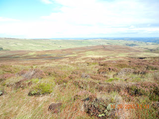
View over Yorkshire from just after the top of Black Hill
After the second reservoir it was a gentle climb to the North, at the top of which the pub on the A62 comes into view. This is the point at which I had been told to call James to collect me at the end of the day’s walk, as it would take him the same time to drive to the meeting point as it would me to do the final mile or so. There I had to wait for the best part of half an hour before he arrived.

Then it was a drive back to Torside through Yorkshire and Derbyshire. This was a pleasant trip, with the last stretch over the high ground a couple of miles to the East of Black Hill. It reinforced the fact that I had done a lot of climbing (and descending) during the day’s walk.

Back at the Old House there was a very welcome and unanticipated opportunity to change before James ran me into Glossop to catch a train to Manchester and hence back to London.


A changeable day with sunshine and showers. Warmer than yesterday – temperature 8 to 17C, but mainly 10 to 12C on the higher stretches. 24.95km, 768m ascent, 631m descents. Open country – lots of rocky, muddy head-down walking, but better going on paths or flagstones for 40% or so of the distance. Several places where streams are crossed on stepping stones.

This was the end of my walking for 2012. Originally I had thought I might put in another week in October, but given the shorter and colder days had decided not to do so. So the rest of the Pennine Way will have to wait until 2013.

My totals for 2012 are 990.58km with total ascents of 20,517m.

Tuesday, 18 September 2012

Edale to Torside

This was my first day on the Pennine Way. It hadn’t looked promising when I woke up, with the hills to the West completely obscured in low cloud, but improved by the time I set off.


A glimpse of the sun from the beginning of the Pennine Way
Edale is the Southern end. It was a few hundred yards from the Ramblers Inn, and I was on the path shortly after 9:00. It was now a bright morning but cold. The initial stretch is across fields, and climbs steadily, giving the feeling that one is already climbing to Kinder Scout, the tallest peak in the Peak District National Park. It’s deceptive, though, because having steadily climbed 100m I lost 90% of the gain as I descended into Upper Booth. By this time the weather had worsened, and there was an intense shower, so it was on with waterproof trousers and a cover for the rucksack. Changeability was to be the characteristic of the day.

After Upper Booth the path begins to climb steadily, until one reaches Jacob’s Ladder a mile further on. This was my second Jacob’s Ladder: the climb up from Cheddar has the same name. Are there others? Apparently it was biblical Jacob’s ladder where he dreamt that he saw angels climbing to and descending from heaven. As well as a common (?) geographic name, it’s the title of a film, of a part of an electrical circuit, and probably all sorts of other things. At any rate the one at the head of Edale is a steep set of steps that rise some 70m.

The view back down Edale as one climbs Kinder Scout
After Jacob’s Ladder it’s a further long steady climb over open country to Kinder Scout at a height of 623m. Like other high points in the Peak District it’s not a distinct peak, but merely the highest position in a fairly large high area. The country here is windswept, and it’s fortunate that there is a series of cairns, as otherwise it would be almost impossible to find ones way. There are lots of areas of what looks like gravel, plenty of rock, and not much vegetation. Edale had been limestone; this is millstone grit. The weather now was cloudy but with occasional breaks to reveal great views all the way to Manchester and beyond to the West.

After a further difficult rocky path along the edge of the escarpment I reached Kinder Downfall, where the infant river Kinder falls fifty metres or more over the escarpment. There must be a point to cross the river just above the falls, but I missed it, and didn’t find a place to cross until a couple of hundred metres upstream. Just before I did so a red grouse shot by me at high speed. It turned out that someone else had missed the crossing and gone even further upstream where he had put up the grouse. It was the first of many grouse seen that day, generally in loose coveys of half a dozen birds seen at some distance. It’s not clear whether shooting has now finished, and the majority of grouse survive, or whether shooting continues well beyond the Glorious Twelfth.

Looking West from the Kinder escarpment
After crossing the Kinder the path continues along the escarpment, with a steep fall to the left and higher ground to the right. This is the spine of England: Water to the left flows into the Irish Sea, and to the right into the North Sea. It’s rocky going, and I needed to keep my eyes firmly on the ground. Not so after descending steeply into a col and then climbing to the trig point at Mill Hill. After this it’s a paved path across blanket bog, al at a fairly level height of 500m. The map shows it’s about 4km from Mill Hill to the A57 crossing, but it feels a lot more. Apart from some reasonable views to the East this is dull, featureless moorland.

After the A57 it’s a long steady climb to the next peak at Bleaklow Head. Initially it’s just a steady climb up a well defined and easy path, but the second half is much worse. Most of it is effectively along a streambed. I had managed to keep my boots relatively dry up until now, but this was no longer possible. And it turned rainy again as I climbed. Four guys had passed me shortly after I left the A57 crossing, looking rather ill-prepared for the unpleasant conditions that now prevailed. I didn’t see them again. so since there appeared to be no alternative I presume they completed the whole of the route I was to follow down into the Torside valley. I imagine they would have been pretty wet when they finished.

After the hail storm
Just before I reached the top of the valley leading to Bleaklow Head I saw a peregrine taking another bird. It seems improbable that it was a pigeon in this sort of open country. All I saw was a scattering of white feathers as the victim and raptor disappeared from view not much more than fifty yards away. There were three other raptors in close attendance, one of which was another peregrine, but the others were considerably smaller – perhaps juvenile tiercels in attendance for the hunt, or more improbably merlins seeing what was going on.

Just to complete the extraordinary range of experiences there was a sharp squall just a few minutes later, with hailstones stinging my exposed ears. It lasted a good few minutes while I huddled up with my back to the wind, and the ground became covered in hailstones which persisted for a good half hour in the now very cold conditions.

Bleaklow Head itself is another indistinct high point marked only with a cairn. The path starts down at a fairly gentle pace, but soon becomes steeper and wetter as it follows another stream down to the next valley. Then it crosses the stream and rather unkindly climbs up again to the shoulder of a steep valley where the stream – the Torside Clough - cuts a deep V. The path, as James Crook (my B&B host) was later to describe it, is heads down walking: you have to keep your eyes firmly on the ground ahead to avoid tripping. And it’s right on the valley escarpment. Only a mile from the end of the path one is still at a height of 400m or so. Then it’s a steep descent to the side of the Torside Reservoir.

My B&B - the Old House at Torside, near Glossop
As I reached the road there was a sign for the Old House, my B&B for the night. It was just as well: the directions I had downloaded from the Internet showed at was a good couple of miles away. Moments later James appeared in a car, and offered me a lift, which I declined. The goal is to walk all the way. I reached the Old Houses about fifteen minutes after seeing James.

There is was out of wet clothes, everything into the drying cupboard, and a trip to the local pub. The Old House doesn’t do evening meals, but charges just a couple of pounds to take one down to the local pub a couple of miles away and o bring one back afterwards. Excellent value!


Very dismal at first light, with nearby hills shrouded in low cloud. Better, and almost bright, by the time to depart. The frequent showers, sometimes heavy, with brightness between. Hail late afternoon. Cold and windy. Temperature 7 to 15C, but mainly 7-10 on the tops, which was where I was walking for most of the day. 28.61km; 700m ascent, 750m descent (estimated). Mostly high level walking, rocky and uneven, but about 25% was fully paved with large slabs of rock. Quite a lot of the other walking was in stream beds, and inevitable muddy and wet.

Monday, 17 September 2012

Buxton to Edale

A wonderful day!

Buxton's elegant Opera House
I had an excellent breakfast at Roseleigh, luggage transfer was readily arranged, and I was on my way before 9:15. It was a gentle stroll through the centre of Buxton – very attractive, but an unusual mix of up-market shops and charity stores – and then out of town to the East.

This is initially through rolling open country – all cattle, sheep, or untenanted greed pasture. Then it becomes industrial, with a huge limestone quarry with massive buildings, the purpose of which it was impossible to determine, activity everywhere, and an endless stream of lorries coming and going. It’s difficult to believe that this much limestone and products can actually all be consumed, but it must be. There are regular signs warning people not to stray too close to the edges, and to be wary of blasting. It’s all so huge that the vehicles down beneath almost seem like models. The main Tunstead works must be the best part of a mile and a half long and a mile wide.

After the railway crossing at the East end of the quarry and works the path climbs steeply away from the noise and activity. Cresting the hill it’s all suddenly behind one, and the rest of the day’s walk was in unsullied countryside.

Tunstead Quarry - a huge scar in rhe Peak District
Tunstead itself is marked as a village on the map, but it seemed to me little more than three or four farms close to one another, and for most of the rest of the day it was simply a question of navigating across open fields. Derbyshire’s way marking is very poor compared with Cheshire’s, but luckily the fields seemed to correspond with the map, so it was (until the afternoon) easy to find my way.

Just before I finished the cross-country stretch I thought I saw, very fleetingly, a spotted flycatcher. Out with the binoculars, and a ten-minute pause to see if I was right. Initially I saw only a couple of chiff-chaffs (too late in the year for willow warblers, I think) in the moss-covered dead tree, but then the flycatcher re-appeared. I was very pleased with myself: I had thought the jizz was a giveaway, and so it proved. Spotted flycatchers have a much more upright stance than warblers, and flit very short distances to feed.

I finally reached the Limestone Way, one of the major trails in the Peak District – but only followed it for a mile or so. The stretch I had to follow was through Hay Dale, which according to the signage is one of five Derbyshire Dales which make up a National Nature Reserve. It’s very attractive, as is the farmland through which I walked after leaving it. There are limestone bluffs on either sided of the valley. They’re not particularly high – perhaps 50m at the maximum – but they give the valley a pleasant intimacy. In other geology there would be streams at the bottom of valleys like this, but her it is limestone, and much of the water finds its way underground rather than babbling along the surface.

Limestone cliffa in Hay Dale
Towards the end of this stretch I passed a huge store of green silage bales alongside great barns, These proved to be full of cattle which were in great long covered pens being fed by some kind of automatic distributor of fodder (hay? silage?). It seems that these beasts are indoor industrial converters of grass into beef, and are denied open grazing. I’ve never seen anything quite as intensive in cattle farming, and it really contrasts with the cattle one sees in surrounding fields living a much more natural type of existence.

I reached the small village of Peak Forest, on the busy A623, just after 2:00. It comprises a church, a pub, and a few houses. Time for a pint at the Devonshire Arms – but a very dismal pub. It was so dark inside that I thought for a moment that I must still have on the dark glasses I’d worn earlier in the day, but it was actually just plain gloomy, and I’d have promptly gone elsewhere if there had been any alternative.

The map showed that form here on it was pretty well due North to Edale.  It seemed simple enough, by a farm and alongside a grove of trees, where I watched a family of ravens putting on a spectacular flying display, with that characteristic croaking call.  Yet I still managed to lose my way after a mile or so. It was only when I got out the compass that I realised that I had started walking to the East rather than to the North. The country was relatively featureless, and I only got back on track when I found a signpost at a bend in a lane. It still took me a while to work out precisely where I was, even though it can’t have been much more than a mile since the last position of which I was certain. It was only when I realised that I was due North of a trig point I could see on the horizon that I worked out exactly where I was. Not impressive – my only excuse was that it was very windy and hard to keep the map under control.

At the top of Mam Tor
The next mile or so was flat going on the tops of this upland area. Then it changed to a gentle descent to a couple of roads I had to cross, with a climb on the far side. The views now became quite stunning – the impressive mass of Mam Tor almost dead ahead and only a short way off my track; great sweeping views to the East and West down valleys in each direction.

After crossing the roads it was still a couple of miles to Edale, but I decided it would be pretty poor form simply to walk on by, so I climbed to the top of Mam Tor – only 70m or so more than I’d have to climb in any case. There I found a somewhat surprising sight: a bride and groom in wedding finery, blowing in the wind, having their photos taken by a couple of guys with heavy duty cameras. Their wedding had been on Saturday; this was simply (uniquely?) an extra event. Despite being in typical British wedding garb they both had somewhat accented English. Polish? Spanish? I should have asked. It was chilly, too, and I felt for the girl with bare shoulders until her gallant husband lent her his jacket.
After they’d finished their photo shoot I had the hilltop to myself. Magnificent – the views in every direction are quite amazing.

Edale, looking West from the Mam Tor descent
Then finally it was the descent into Edale. As I’ve felt beforehand it seemed that the descent was much longer than the preceding climbs, even though this is a physical impossibility. As I descended the clouds dissipated, and the far sides of the Edale, and the valley itself, became even more attractive in the evening light. It was a fitting end to the walk on a wonderful day.

I reached the Rambler Inn after passing under the rail bridge by Edale Station. It’s a surprisingly busy line as it connects Sheffield and Manchester. An excellent room, a bath, and a very acceptable dinner concluded the day.


Bright but chilly at first, becoming increasingly cloudy throughout the day. Then brightened up and became sunny again at the end of the afternoon. Temperature 12 to maximum of 18C, but predominantly around 15C. 24.61km; 570m ascent, 622m descent. After leaving Buxton it was all cross-country – mainly footpaths, but occasional tracks. All very stony, and often very uneven.

Friday, 14 September 2012

Congleton to Buxton

My starting point - the Lion & Swan in Congleton
This was expected to be a long day, with a 5:30 train to catch from Buxton, so an early start was indicated. But there was another map problem to resolve first – I had left at home the OS Map required for the latter half of the journey. Not an impressive performance this week! So I had to wait until 8:30 for W H Smith to open. Fortunately they had the required map, but at a cost almost twice that which applies for internet purchases. I was the first customer of the day, and on my way by 8:35.

The first bit was out of Congleton through a riverside park and then an area of housing. One minor mistake required me to retrace my steps a couple of hundred yards, but after this I successfully found the Macclesfield Canal, which rather surprisingly was above the level of the nearby houses and involved a short climb to the towpath.


Telford's aqueduct over the River Dane
After that it was easy going for eight miles or so, with absolutely no chance of going astray. The towpath was fine, though muddy in places. The canal goes pretty well due East for the best part of two miles before crossing a rather fine aqueduct over the River Dane before swinging to the North towards Macclesfield. The bend is part way through the twelve-flight Bosley Locks. These were being navigated by a succession of narrow boats in both directions. At least this makes it marginally faster than if all the boats are going in the same direction, as lock gates are generally set favourably if the last boat was travelling in the opposite direction.

This, according to the notices alongside the locks is Telford’s engineering, and dates from 1830. The locks rise 34 metres, or an average of nearly ten feet each. They were the only locks I encountered on the canal stretch of my walk, so apart from the two to three hours it takes a boat to work its way through the flight the rest is plain sailing – or, more accurately, motoring. The locks each have a pond alongside which captures half the water when the lock is being emptied for downwards traffic, and supplies half the water required to fill it up again for upstream working. Or that’s the theory: some are now derelict, and I don’t think anyone now works the locks as they were intended to be worked.


Two of the Bosley Locks
After reaching the end of my canal stretch it was across a footbridge to a footpath leading to Sutton Lane Ends. The first half of this is alongside the Sutton Reservoir, after which it’s across country to Sutton Lane Ends itself. Bells were in full sound, and there was a wedding at the church with a rather splendid car waiting at the gate. The bridal party was making its way up the path to the church. It was now 12:05, so I guess she was just fulfilling expectati0ons by being just a little bit late.

It was then a gentle roadside walk to Langley, three quarters of a mile away. My target time was 12:30, and I beat it by ten minutes. Unfortunately the village pub was closed (open only in evenings during the week), but luckily there was another a further uphill mile away at the beginning of the Macclesfield Forest. A pint and a packet of nuts, and then the start of the uphill bit.

It was a long, steady climb over the next mile or so before reaching the first of the high points at just under 400m. It was threatening to rain, and there were a few spots now and again, but not enough to justify getting out the waterproofs. Then it was down a rough track to the curiously named little junction at Bottom of the Oven.

For the next mile and a half three was no alternative to the road, though fortunately there was relatively little traffic. This is now open country with good vistas in all directions. At the top my minor road joined the busy A537, which is the main crossing of the hills from Macclesfield to Buxton. It would be a much more unpleasant part of the journey had it been necessary to walk along the road, but fortunately there is a footpath which cuts the corner to the peak at a pub called the Cat and Fiddle, at an altitude of 500m. The weather was as advertised – cloudy, threatening showers, and very windy. But at least the wind was behind me rather than in may face.

The end of the Cheshire section, and into Derbyshire
There was then a minor road – which presumably had originally been the main route – down to Derbyshire Bridge, which is (not surprisingly) where one crosses into the next county. This side of the summit at the Cat and Fiddle is proper moorland with plenty of heather (now no longer colourful) and rough pasture. I heard red grouse a few times, but never saw any. It’s obviously shooting country, because one can see areas where the heather has been burned in rotation to encourage new growth for young grouse.

A final ascent up a rocky track leads to the 479m spot height where the view across Derbyshire is revealed. Then it was a long descent down an incredibly rocky path into Buxton itself. A coupled of mountain bikers passed me here. One actually dismount ted to go down one of the worst stretches. I can’t say I blamed him: the path was mainly fist-sized loose stones with occasional outcrops of bedrock. It wouldn’t be difficult to lose traction and go for a real pearler.

The last stretch was through the Western parts of Buxton into the town centre. There I found Roseleigh guest house, where I was due to stay on Sunday night, and to which I had forwarded my luggage. It was just after 4:30, so I had made pretty good time. I was able to change into civvies and make my way to the station in good time for my train.


Cloudy throughout the day with only occasional sunny intervals; light rain for half an hour towards the end of the afternoon. Temperature 12 to 18C. 33.76km; 679m ascent, 475m descent. Out of town by road, then 12km of canal, then path/road/path/road across the hills into Buxton.

Thursday, 13 September 2012

Lea Farm, Wybunbury to Congleton

Lea Farm breakfasts follow a rule. Alan is in attendance to start, with non-stop jokes (“I have a sense of humour, you see”), but under house rules is banished for the main course.

Crossing the main London to Manchester (West Coast Main Line).
A Virgin train - soon to be history now that Richard Branson has lost
the franchise.
The only real problem was arranging a taxi. Half the numbers for Congleton taxis were no longer current, and it took me ages to find one who would take my baggage – Bill of M Tax, who said that while he wasn’t able to do it himself he’d get someone else to do the deed. He’d get the driver to see me in the evening to collect the money. I was slightly apprehensive, but it turned out to be just fine. But it meant that it wasn’t until nearly 10 o’clock that I was able to get away.

The South Cheshire Way is only a quarter mile or so from the B&B, so I was fairly rapidly back on track. This time I had made absolutely sure that I had the right maps with me: yesterday’s experience is not something I wish to repeat. The first stage was due North across open country, with only an occasional few hundred yards on roads or farm tracks. The only unusual feature was that the path crossed the Crewe Golf Club, and I had to wait for golfers making their shots. Conclusion: most people can’t sink 10 foot putts.

That was also where I had the pleasant surprise of a call from Katie. I know we all take it for granted now, but it’s still extraordinary that my daughter can call me from New York after completing a morning run (she’s training for the Reggae half-marathon in Jamaica in December) while I’m tramping across the Cheshire countryside on the other side of the Atlantic.

Another maize field - but with a decent track through it
This part of Cheshire is rural between quite large towns, and the SCW navigates its way without too much urban blight. But it’s not very interesting country – relatively flat, with only minor undulations, and no sights of particular interest apart from one country house in Cheshire Tudor style. Unfortunately the path doesn’t give a good view of the front, so I was only able to see the rear and the outbuildings.

So the day’s project was an agricultural survey. How was each field used, and what proportion was devoted to each kind of farming? I didn’t distinguish between fields with cattle (or sheep, though those were rare) and those where hay had been taken recently or was due to be cut for late silage: all were categorised as “pasture”. But I did distinguish between other crops. And I didn’t take account of fields either side of roads or canals: my observations were restricted to fields I actually walked through or along the edge.

Haslin gton Hall - traditional Cheshire architecture
My log for the day went Pasture (P) – P – P – P – (village) – P – Horse Paddock – P – Barley (B) – P – P – (across the main London to Manchester railway, then roadway) – Rape (autumn sown) – Maize (M) – M – M – (village of Weston) – P – P – (across A500 road) – P – P – P – (railway) – Wheat Stubble (WS) – road and track – Golf Course – P – P – P – (Haslington Hall, half timbered and rather splendid) – P – P – WS – Field Beans (completely black) – P – P – P – P – P – P – P – R – Road – Canal – Large Tree Nursery – P – P – P – Standing Wheat – P – WS – WS – Farm Tracks – Field Bean (harvested – just bales of stalks, etc.) – P – P – Road and track – M – M – edge of Congleton housing – Astbury Lake and park – downtown Congleton.

I know the list looks pretty anal, and I’m sure you’ll just skip this bit, but this blog is for me as much as anyone, and it’ll serve to remind me exactly how the day was spent.  And the chief conclusion is that SE Cheshire is predominantly cattle country, whether for beef or dairy. Even the maize, after all, is grown as cattle food. (On the subject of maize, I was wrong in my conclusions yesterday: a minority of plants have two ears of corn, and a very small number even have three. Whether it’s a question of the specific variety or the fertility of the ground I just don’t know. Certainly yesterday’s plants were often rather small and poorly developed.)

Astley Country Park and Lake, SW of central Congleton
The first 10km or so were pretty well due North through farmland. I then elected to cut a corner where the SCW turns back on itself at an acute angle where it meets the Trent and Mersey Canal. This meant a bit by road, which after crossing beneath the M6 meets the canal at a lock where there is a café which managed to stretch to a beer. After a couple of miles Eastward along the canal it was back into the countryside on a Northerly course. One could do the whole stretch from Lock 57 to Congleton by canal – Trent and Mersey and then the Macclesfield Canal, but it’d be a good bit longer if easier to navigate.

The final northerly stretch finished up at the SW corner of the Congleton conurbation, where there is an attractive lake and country park. Then it was into the centre of the town, where I came across my hotel, the Lion and Swan, without actually having to check the more detailed map. It was just after 7:15, and had been a surprisingly long day.

A bath (no feeble shower here), a rather good Indian meal, and then bed.


Sunny but cold first thing, but cloud increasing throughout the day, and fairly dull by late afternoon. Temperature 13 to 20C. 32.29km; 240m ascent, 188m descent. Fairly flat, but with minor undulations in places. Mostly farmland, sometimes heavy going. Roads and canal towpaths for about 15% of the journey.

Wednesday, 12 September 2012

Whitchurch to Lea Farm, Wybunbury

An excellent breakfast was provided by the wonderful Lesley Smith, and after the cab arrived promptly to collect my luggage I was on my way a few minutes after 9:00. Having scouted my way around Whitchurch a couple of times the previous day, I was clear about my route. First it was through the town centre to take a few photos (I was particularly eager to capture an image of the rather splendid church), and then a right turn to the North. It was all very straightforward.

Whitchurch's wonderful 18th Century church
But after I had walked a little over a couple of miles it was time to consult the map. Disaster! I had put the wrong OS sheet in my rucksack!

To go back? No. I had studied the route pretty well the previous evening, and was reasonably confident that I’d be able to reach Marbury directly to the North, and then be able to follow waymarks for the South Cheshire Way, which I was intending to follow all day to Wybunbury. And after a slight hiccup there it was – a nice yellow arrow on a sign with the reassuring letters SCW.

And on the whole it worked. There were further arrows at regular intervals. Most carried the promising SCW legend, and those that didn’t were clearly (or hopefully?) still following the required route.

But it was slow going. The route is largely across open farmland. It was not too bad when it was recently harvested fields of grain or well grazed fields. But there were a lot of fields where there was long wet grass, and some where cattle had made the going quite rough. There were also several fields of maize, particularly late in the day – well over head high, too. Fortunately there were either cleared (but muddy) paths through the corn, or the path was at the side of the field with just about enough room to make ones way without tramping between rows of plants. And I certainly learned about maize. It appears that each plant bears only a single head of corn. I had always thought there were multiple heads per stalk.

Cornflowers - now rare - and other summer flowers beside the track
There were occasional points where the direction of the arrow showed that it was necessary to cross an open field, and the direction was a little inaccurate and made it difficult to find the stile at the far end. The worst bits were when the path met a road and there was no obvious continuation on the other side. Turn left or right? Most of the time I got it right, either because I had somehow recollected the right way from my earlier studies of the map, or because a check on the compass suggested which way was more likely. But I got it wrong on a couple of occasions, and had to re-trace my steps. Finding the hoped-for SCP waymark after a bit of road walking was always reassuring.

Two minor disasters to add to the first. On one stile I missed my footing and fell into a bed of nettles. It’s not so much the indignity and stings of the fall itself: getting up without getting a lot more nettle rash is quite challenging. And then after, with some relief, finding a reassuring SCW sign off the road, the immediate challenge was a newly-dug ditch right across the path. I experienced much slithering and accumulation of mud before I managed to cross the stile immediately on the other side and a couple of metres higher than the ditch. Obviously (some) farmers don’t consider the maintenance of public footpaths a priority.

My fan club! Why do cattle sometimes follow altogether too closely,
and sometimes completely ignore you?
The worst route finding of the morning session was just after I had found an excellent pub for a very welcome pint. There were cyclists lunching there, and I had great hopes that someone would have a map. Somebody did – but it was the wrong one, and the pub was just to the East of the end of the map I was offered – and so I was no further forward. The immediate aftermath was that I took the wrong direction at the next major road and had to retrace my steps before finding the next SCW sign. Unfortunately there was no help from the owner of the pottery just off the main road, despite her having a range of leaflets about Cheshire attractions. The maps had no real detail, and didn’t even mention Wybunbury.

By mid afternoon I had at last crossed the Main Line of the Shropshire Union Canal, which I thought was about half way along the route from Marbury to my B&B. It was somewhat disappointing that it had taken so long. Maybe, I consoled myself, it was more than half way. But no: my original recollection was correct. Half way it was.

After that it was pretty well solid maize for the next couple of miles. It was easy to find my way, but very muddy and slippery underfoot. And then the next A Road – busy, but fortunately with footpaths to the side so not dangerous. This, I recollected, I had to follow to the North, and then turn off on a minor road to the East, where I would hopefully find Lea Farm signposted.

Back on track - a snack at the Boar's Head before the final stretch
to Lea Farn in Wybunbury
Wrong! The minor road was certainly on the SCW, but after a little more than a mile it was signposted off to the left. I continued in the expectation that the Farm was just a few hundred yards away. There was no sign at the crossroads I then came to, and enquiries of a couple of locals were not reassuring. But finally there was a stroke of good luck. I called in at a rather grand house with the hope that someone would have a map. They didn’t – but Emma Mottishead knows the Callwoods (her sister-in-law’s brother is apparently married to their daughter) and was able to give me accurate directions and a little sketch map – which proved to be the only useful map I’d had all day.

The only issue was that her estimates of time for me to complete the walk were somewhat on the low side. 40 minutes was more like an hour and 40 minutes. (When I examine the map later, it turned out to be more than twice as long as going by the SCW.) But at least there was a pub on the way, where I was able to get a snack and a pint. Very welcome.

I finally arrived at Lea Farm a few minutes before 8:00 p.m. Boots to sit besides the Aga overnight, other damp clothes out to dry, a long shower, and at last a chance to relax. The key lesson is to double-check that one has the right maps before setting out for the day!


Increasingly cloudy in the morning, and then rain, heavy at times. Clearing in the evening. Temperature 15 to 19C. 34.0km (estimated from map – insufficient battery life to record); 261m ascent, 290m descent. Fairly flat, but with minor undulations in places. Mostly farmland and heavy going, but roads from time to time and for last five miles or more.

Tuesday, 11 September 2012

Ellesmere to Whitchurch

Dappled sunlight on the Llangollen Canal
Susan had been exhausted by yesterday’s endeavours, and was worried bout getting back to London early enough to rest ahead of her day volunteering at the Zoo on Wednesday. So after an excellent breakfast the taxi booked to take our luggage on to Whitchurch took her as well to catch a train back earlier than originally intended. So I set off alone at 9:30.

After a few hundred yards down the main road it was back to the Llangollen Canal. Because I took the wrong access point to the canal, the first bit was a tunnel, 80m long, under the road junction. But then it was a lovely walk along the towpath in dappled sunlight, with Blake Mere off to the left. This is one of a series of meres in North Shropshire, formed by glaciation in the last ice age. This, and Cole Mere a mile or so to the East on the South side of the canal, are surrounded by woods and very attractive. Blake Mere is reserved by the Ellesmere Angling Society as a private fishery, but Cole Mere appears to be open for a wider range of water sports – though it was too early in the morning to be certain of this.


Blake Mere, to the SE of Ellesmere
After the meres, and a woodland walk alongside the canal, it turns through a right angle to the North and the surroundings become much more open country. But there are still stretches of woodland, and the overall feeling is of a peaceful country walk. I came across two points at which British Waterways staff were working on the canal – once where a protective wooden beam needed to be reattached to the side to protect the brickwork on the side of a bridge opposite the towpath, and later where there had been a breach of the canal side and water had flooded over a field.

While this may seem unusual, it must happen on these canals from time to time. They are often higher than the surrounding countryside, with built up banks on one side and occasionally both. In this case I had to get down into the field and walk a quarter of a mile across a crop of failed barley which appeared to be so poor that I doubt that it would have warranted harvesting. Such has been the summer of 2012. Then it was a further mile or so before I was offered the choice of continuing along the canal or crossing the extensive Nature Reserve of Fenn’s, Whixall and Bettisfield Mosses. Having spent the last three and half days walking along canals, I elected for the Mosses.

Pathway across Fenn's Moss
This is another feature of previous local glaciation – huge, flat areas of peat bog, but with pathways across and an old railway line to the West. It’s not unlike the heaths of east Anglia, with similar vegetation of heather, scrub birch, and other acid-loving flora; pinewoods around the main area of open country. And obviously much of the same fauna, too: almost immediately I saw a couple of late hobbies hawking for dragonflies.

This was a pleasant digression from the canal, and for three miles or so I saw nobody as I crossed the Nature Reserve. Nor was there any significant wildlife, as this is not the busy time of year for birds apart from the odd hobby, crow or woodpigeon. But it was sunny and warm, and very enjoyable. Then it was back to the canal for a further mile before leaving it for good to walk across country to Whitchurch.

The first bit was on minor roads. I saw no traffic apart from a tractor leading a herd of cows back to their field after milking. I haven’t seen it before, but they seemed to be well trained to follow their motorised guide. Fortunately I had just passed the farmyard entrance before they came out onto the road, so I wasn’t trapped on the roadside by beef on the hoof.

A bridge on my last stretch of the Llangollen Canal
After a mile and a quarter or so of road walking it was back over the fields for the final stretch into Whitchurch. The last field was another example of just how poor this summer has been. It was wheat this time, and probably just about worth combining, but I don’t recollect ever before having seen unharvested cereal crops a third of the way through September. Eventually I managed to find the stile out of the field (so overgrown that it was apparent only at a range of two yards), to cross the bypass, and then cross a final field with overgrown stiles at either end before finding a passable path into town. Map reading skills essential: at least there were footpaths as advertised.

Then it was a few hundred yards to my B&B. It was relatively early, so after changing and a cup of tea it was in to Whitchurch for a spot of exploration before writing up the last couple of days and updating the blog. The town has an attractive old centre, and a very unusual church, and there appears to be a reasonable range of choice for dinner tonight.


Sunny intervals, and no rain, despite the forecast. Temperature 15 to 20C. 23.01km; 40m ascent, 30m descent. Virtually completely flat, except for last 5km which involved minor climb and descent.

Monday, 10 September 2012

Llanymynech to Ellesmere

Susan - before the rain!
Accompanied by Susan, we stayed at the Cross Keys in Llanymynech on the Sunday evening after a train journey to Welshpool and a taxi for the last eight miles. Awful! Fortunately we managed to move from the E- twin room to which we were shown initially to an E+ en-suite family room. But it was still pretty dire. A brief stroll after arrival along the Montgomery Canal revealed that Llanymynech must be the slug capital of Wales – huge brown slugs ten centimetres or more in length were on the path in unbelievable numbers. Is this a local phenomenon, or just a characteristic of a very wet summer?

The evening was not improved by dinner: the steak I was given was completely inedible! But extra wine was a minor compensation. Breakfast was in the company of three women walkers, who were doing the whole of the Offa’s Dyke path, and who must have been equally disappointed with the Cross Keys – though we didn’t actually ask.

Shortly after 9:30 we were on our way along the Montgomery Canal. The bit through Llanymynech has water, and there was actually a narrow boat moored outside the little visitor centre by the bridge. But it can only have a very limited range, because within half a mile the canal becomes dry.  This stretch is heavily overgrown, with often quite mature trees in what had been the water course. Compared with what we had seen before and after, this looks a major challenge if it is ever to be restored. But it’s still attractive country.

Work under way on the Montgomery Canal
After Pant the line of the old canal bears away from the line of the hills to the West, and crosses open country, with much less in the way of tree cover. In total there are about three dry miles, and a half mile of the most Northerly section has already been renovated, even though the OS  map shows it as still dry. And they are currently working on a further 500m or so. It looks pretty demanding work, though. The bottom is covered with bituminised cloth, and then with breeze blocks. Nobody working on a Monday, though, so presumably it’s all volunteer work carried out largely at weekends.

It would be fascinating to know how much it costs per metre, and how long they think it’ll take to complete the whole job. Quite apart from the basic canal work there will need to be half a dozen or more new bridges where roads or tacks now cross at canal level, and the aqueducts over the River Vyrnwy to the Southwest of Llanymynech are even more of a challenge. I wonder whether they have any idea when (or even if) the whole 35 miles will have been reinstated? It would certainly be a huge achievement.

Nearly there! The last milepost on the Montgomery Canal
Lunch was at the Queen’s Head, which is just off the A5 where it crosses the Canal. This is two miles or more North of the point where the canal has been fully restored and is readily navigable. Then it was a further four miles to reach the junction with the Llangollen Canal. The first stretch was wooded, then it was largely across open country, and finally up a flight of four locks to the junction. We encountered half a dozen or more narrow boats working their way Southwards, so the of the Montgomery Canal that is open is obviously popular. It suggests that there’ll be even more use made of it once it has been opened up more.

At Lower Franklin we cut a corner and saved a mile or more by walking across four or five fields to meet the Llangollen Canal again a mile or so to the Northeast. The path was for the most part obvious, but it does help to have binoculars so you can see where it crosses the next hedgerow. Then it was a final two miles or so to reach the Ellesmere junction, where we left the canal to walk into town. Frustratingly Ellesmere is right on the edge of the OS sheet, and I had sent the next sheet on with the luggage, so the route we took to get to our B&B was longer than it could have been.

Ellesmere Church
It was up a slight hill – Love lane - between damp walls with little room for passing traffic, and then down Church Lane to the Mere. And then it was a final quarter mile or so along the Mere to reach Mereside Farm.

Our accommodation was a wonderfully welcome sight – a decent bedroom, and separate sitting room with a corner kitchen. Obviously a good base for self-catering as well as an excellent B&B.

We managed to recover sufficiently to make our way into Ellesmere itself for dinner (indifferent) at the Red Lion, but after that we were early to bed. We’d both found it a long day, and surprisingly tiring. I think it shows that it takes a day or two to get back into shape after a lay-off of the kind we’d had over the summer months.


Cloudy, with occasional showers. Temperature 14 to 18C. 23.2km; 30m ascent, 25m descent. Virtually completely flat, except when level changed after locks on canal and last stretch in Ellesmere.